What a Super El Nino and an AMOC slowdown means for Canada – Richard Mills
2026.06.10
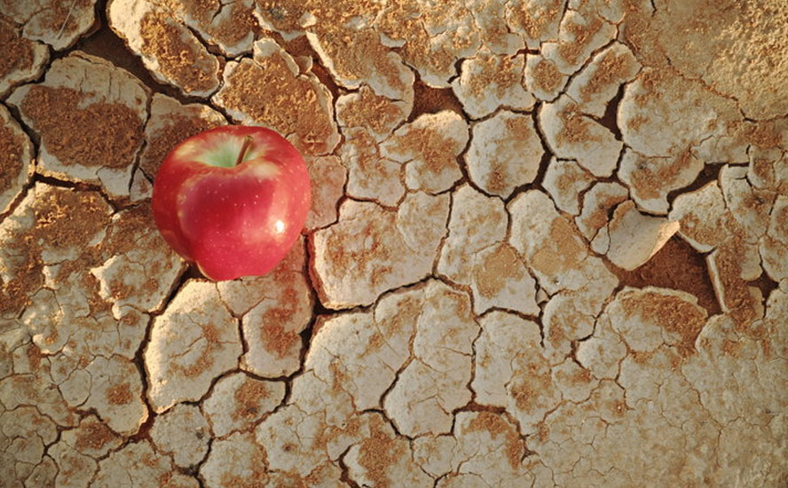
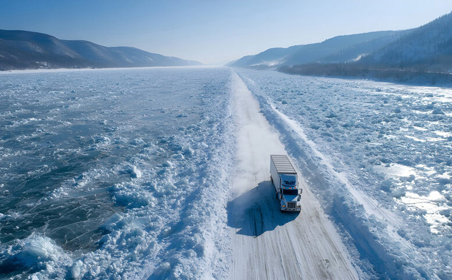
Official summer hasn’t yet arrived, but Stage 3 water restrictions are already in place in the Lower Mainland of British Columbia and in Vernon, a city in the province’s southern Interior.
That means no lawn watering, no sprinklers, no pressure washing, no washing of vehicles, no filling of pools. In Strata buildings, where much of the Vancouver-area population lives, irrigation systems have been shut down, leaving it up to residents to hand-water the landscaping with hoses and nozzles. Thousands of plants will inevitably die.
Vernon-area fruit growers are legitimately complaining they will lose their trees if they can’t water them.
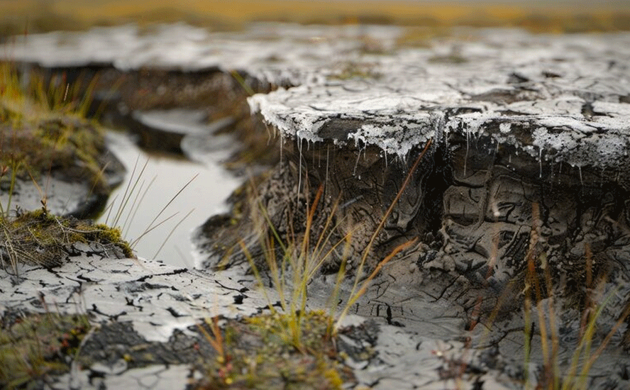
The heavy-handed regulations are in response to a low snowpack, high temperatures and in the Lower Mainland’s case, a watermain project that has taken offline one of the main water supply pipes that carries fresh water from North Shore mountains to Vancouver.
Warm and dry conditions are drastically increasing regional water demand which typically jumps by over 50% during the summer. Mountain snowpack levels are less than 15% of normal for this time of year, meaning there is less runoff to replenish the reservoirs.
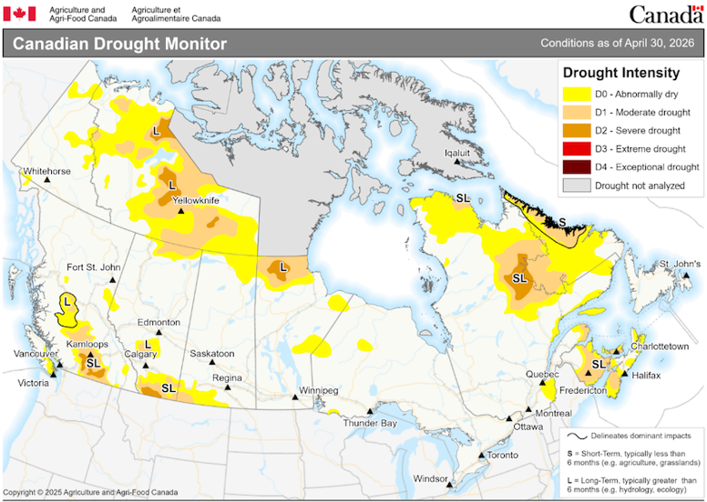
A country-wide drought assessment found that, while much of Canada received normal to above normal precipitation in April, “well below normal April precipitation occurred throughout much of British Columbia, the extreme southern Prairies and northeastern Quebec… [this] led to expansion of drought conditions. At this time significant drought remains in southern British Columbia, southern Alberta, the Northwest Territories and through the Maritime region.
At the end of the month, 27% of the country was classified as Abnormally Dry (D0) or in Moderate (D1) to Severe Drought (D2), including 20% of the country’s agricultural landscape.”
If this sounds bad, it’s only going to get worse. That’s because this year brings with it El Nino, the reoccurring weather pattern that carries extra warmth and drying to Western and Central Canada.
The planet was last in El Nino between May 2023 and March 2024. The last “Super El Nino” occurred in 2015-16 (more on Super El Ninos below).
The winter of 2024 saw record-breaking warmth globally, with Canada experiencing its hottest winter on record.
2023 was the worst year for forest fires in Canada. CBC News reported more than 15 million hectares were destroyed by fire across the country, doubling the previous record, 7.6 million ha in 1989.
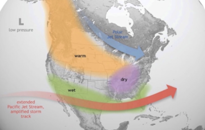
It’s been well-established that warmer, or colder-than-average ocean temperatures have an influence on weather. According to the National Oceanic and Atmospheric Administration (NOAA), El Nino causes the Pacific jet stream to move south and spread further east. During winter, this leads to wetter conditions than usual in the southern US and warmer and drier conditions in the northern US and Canada.
El Ninos generally happen every two to seven years and last between nine and 12 months.
The second year of an El Nino is often warmer than the first.
That’s what happened during the 2015-16 El Nino, which peaked in December and faded in June 2016. The lingering El Nino from January to June made 2016 a record year for warmth.
A lingering El Nino is likely to mean a drying trend in places accustomed to rainfall and vice versa, with implications for agriculture.
The presence of El Nino makes it far more likely that 2026 or 2027 will bring the next warmest year on record.
How does El Nino impact global temperatures? According to the NOAA, it raises heat stored in the Pacific Ocean into the atmosphere, temporarily increasing the Earth’s average temperature on top of long‑term climate warming.
El Ninos mainly influences weather in the colder months. During an El Nino winter in the United States, for example, the southern third typically experiences wetter-than-average conditions, while the northern third sees enhanced chances of below-normal precipitation.
They can also have a major impact on hurricane seasons. El Ninos usually reduce the number of hurricanes in the Atlantic Ocean, particularly the Caribbean. Conversely, El Nino years are typically associated with more activity in the eastern Pacific.
Some computer models are quite aggressive in developing an El Nino into an intense “Super El Nino” by late fall. If this were to occur, global temperatures would almost certainly spike into record territory.
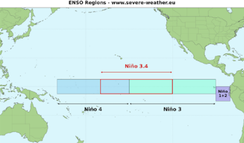
A Super El Nino occurs when sea surface temperatures reach at least 3.6F (2C) above the long-term average.
Such an event is driven by powerful westerly wind bursts and a massive ocean Kelvin wave currently surfacing in the eastern Pacific, claims one source:
Such an intense warming of the tropical Pacific can fundamentally alter the global jet stream and trigger a domino effect that extends across North America, Europe, and the rest of the globe.
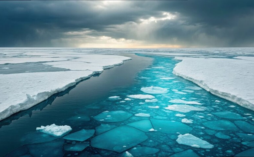
As the world braces for another El Nino, or a Super El Nino, there is a less noticeable but arguably much more powerful climate shift going on, hidden from sight beneath the ocean surface.
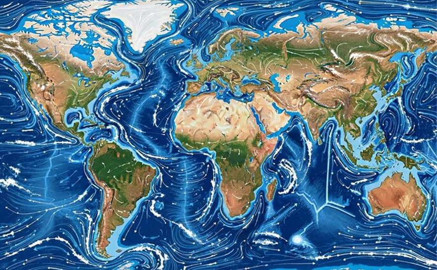
This is the slowdown of the Atlantic Meridional Overturning Circulation (AMOC), a large system of water currents that circulates water from south to north and back, in a long cycle within the Atlantic Ocean.
How strong could El Nino get?
This Thursday, June 11, forecasters from the National Oceanic and Atmospheric Administration (NOAA) are expected to officially declare that an El Nino is underway.
The map below shows sea surface temperatures are warming along the Equator, forming a classic El Nino signature on satellite, in a screenshot from the NOAA’s Coral Reef Watch.
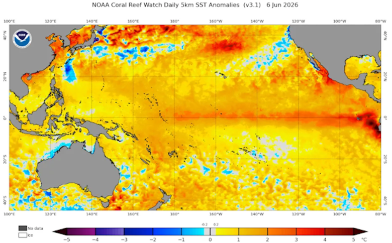
USA Today reports temperatures in the North Pacific have soared to a record high, with the average water temperature in the region warming by almost a full degree Fahrenheit between May 31 and June 3. This is nearly 3 degrees higher than their 30-year normal.
Computer models suggest the water could warm by over 5 degrees F.
As for whether we are heading for a Super El Nino, climate scientist David Swain recently posted on X that, “All signs are increasingly pointing to a significant, if not strong to very strong, El Niño event.”
Remember, to be classified a Super El Nino the water in the North Pacific would have to warm by at least 3.6 degrees F or 2C.
The phenomenon is extremely rare: only four have occurred since 1950. The last Super El Nino was in 2015-16.
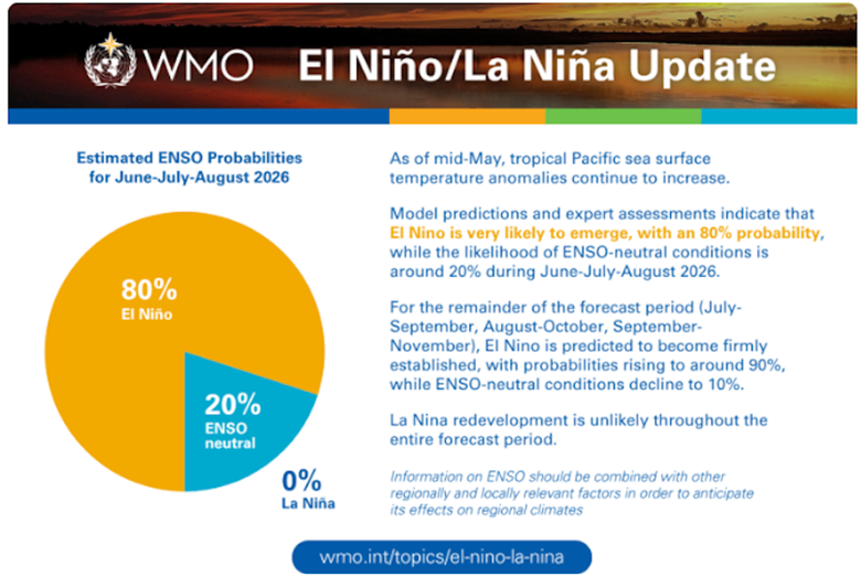
The World Meteorological Organization said on June 2 that there’s an 80% probability of an El Nino event starting this summer, and a 90% chance it will continue until at least November.
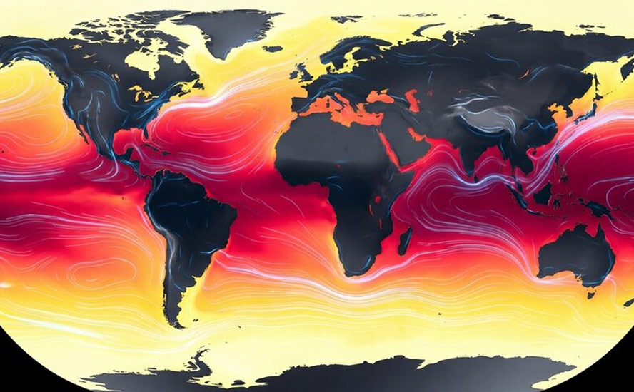
“The science is clear: El Niño is arriving on our doorstep in the coming months with 90% certainty,” said United Nations Secretary-General António Guterres, in a video statement. “The world must treat it as the urgent climate warning it is. El Niño conditions will pour fuel on the fire of a warming world.”
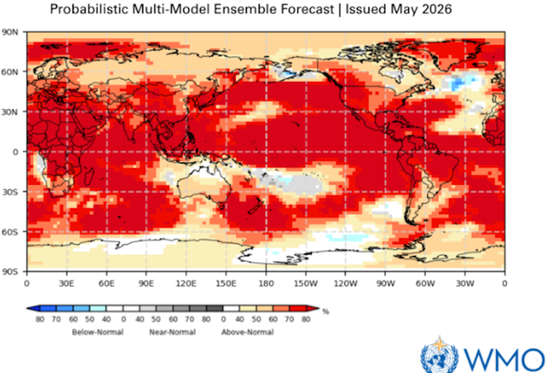
The WMO forecast, mapped below, shows above-average temperatures for most of the world this summer between July and August.
How would a Super El Nino affect Canadian weather patterns?
According to an AI Overview, a Super El Nino typically ushers in unusually warm winters and elevated risks of spring and summer heatwaves — which would show up in 2027 — drought and wildfires across Canada.
Key impacts vary regionally:
- Winter (Warmth & Less Snow): Canada experiences profound warming during El Niño winters, heavily skewed toward the West and Central regions. British Columbia and the Prairies typically see significantly above-average temperatures, depleted snowpacks, and thinner ice on the Great Lakes, which can disrupt winter recreation and hydroelectric power.
- Summer (Drought & Wildfires): The elevated temperatures and dry conditions from the winter often spill over into the following year’s summer. Western Canada and Northern Canada face higher potentials for early heatwaves, severe drought, and compounded wildfire risks.
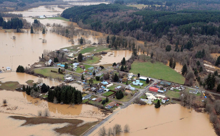
- Precipitation: While the winter can be warmer, it sometimes brings more rain than snow to populated southern regions, leading to potential localized flooding.
- Hurricanes: On a positive note, for Atlantic Canada, El Niño often creates wind shear in the atmosphere that results in a quieter Atlantic hurricane season.
Ryan Snoddon, a Halifax-based meteorologist for CBC News, said in a video that the next El Nino will likely be one of the strongest on record. While this means a quieter hurricane season for Atlantic Canada, it doesn’t mean there won’t be hurricanes, it’s just that there will probably be fewer storms than normal.
The odds of a warmer-than-average winter in Atlantic Canada are increased, he added — good news for Maritimers who typically grapple with huge dumps of snow throughout the region.
Snoddon noted some models are projecting this upcoming El Nino could be the strongest since 1877, which was one of the most powerful and devastating climate events in recorded history.
“El Nino’s impacts will peak late this year and continue right into next year, increasing the chances of heat waves, drought and wildfires for Canada and other parts of the world. Coupled with an already warming planet, this Super El Nino will very likely make 2027 the warmest on record for planet Earth,” he said.
Another video by Global News said that El Nino could bring another bad fire season to British Columbia — it hasn’t happened yet, there are currently only two wildfires being held and 10 under control — along with a warmer-than-normal summer in Alberta and potentially Saskatchewan and Manitoba.
“Drought conditions in the southern Prairies could be made worse by an El Nino-fueled heat wave.”
The first three months of this year were the fourth warmest on record for the planet, though this wasn’t felt in Canada because of a weakening of the Arctic polar vortex, which allowed cold air to escape and settle across the country.
“This year, the University of Hawaii and others show a neutral El Nino in the spring, but the forecast calls for a stronger El Nino by June, more so by September, possibly a Super El Nino before easing next year,” states Global News reporter Eric Sorensen. “A Super El Nino could mean global temperatures two degrees Celsius above normal. There is about 25% of chance that you have a very strong El Nino. It will be one of the most extreme El Nino events. Yuxin Wang says it could bring warmer temperatures to much of Canada, but also more extreme events from atmospheric rivers on the West Coast to wildfires and smoke across the country. El Nino is separate from global warming, but the two together could bring historic conditions over the next year.”
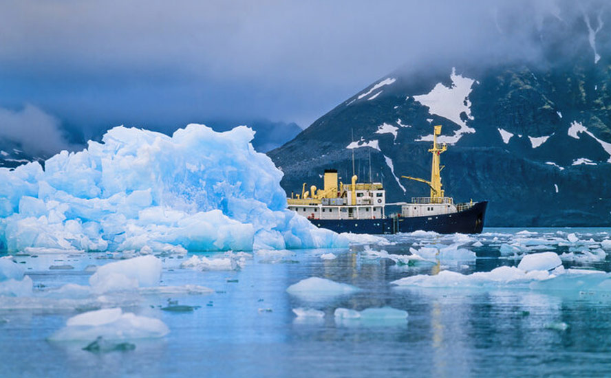
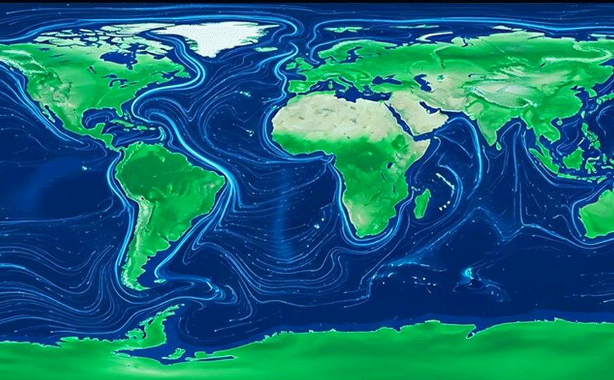
AMOC slowdown
The Atlantic Meridional Overturning Circulation (AMOC) is a large system of water currents that circulates water from south to north and back, in a long cycle within the Atlantic Ocean.
This system of deep-water circulation sends warm water from the Gulf of Mexico to the North Atlantic, where it releases heat to the atmosphere and warms Western Europe. The cold water then sinks to great depths and travels all the way to Antarctica and eventually circulates back up via the Gulf Stream.
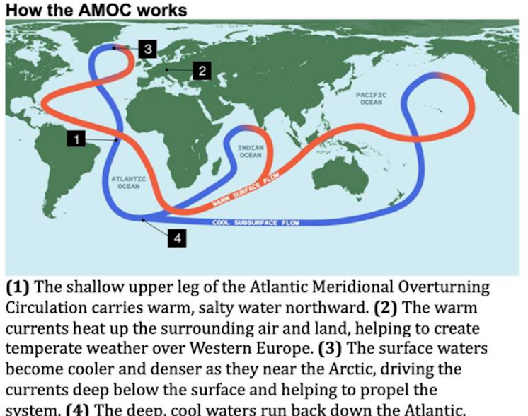
Without climatic disruptions, the currents move water around the globe, along with nutrients key to the survival of marine species.
The AMOC brings warmer temperatures to northern Europe and parts of Canada at the same latitude, moderating the climate in these areas.
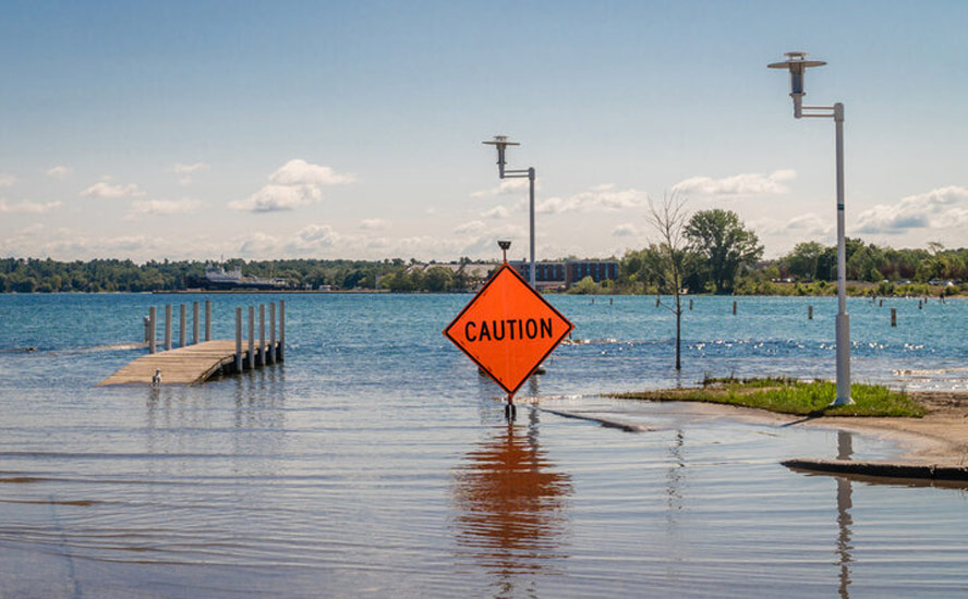
But climate scientists have been raising concerns that rising temperatures are throwing a wrench into the conveyor belt-like currents system. Sensors stationed along the North Atlantic show that the volume of water moving northward has been sluggish, potentially affecting sea levels and weather. If the AMOC were to stop altogether, it could bring extreme climate change within decades, not centuries or millenia — a period so short it wouldn’t even register in geologic time.
AMOC current could collapse within 20 years — Richard Mills
New research reveals this key cog in the global ocean circulation system is currently at its weakest point in 1,600 years and is being further weakened due to the rise in global temperatures.
What could cause the current to slow down, or worse, collapse?
The Guardian reports scientists spotted warning signs of a tipping point in 2021, and they know that the AMOC has collapsed in the past. There is scientific evidence to suggest the current did shut down during the last ice age. Read more at AMOC collapse — a coming climate catastrophe — Richard Mills
Using dozens of computer models to assess the future climate, researchers found an estimated slowdown of 42% to 58% in 2100, a level almost certain to end in collapse.
The upshot from the research is that the AMOC tipping point is closer than previously thought. Previously, the most pessimistic models showed a strong weakening of the AMOC by 2100. Now, the most pessimistic models are the most realistic.
A Reddit post referencing the 2026 study said, The AMOC ocean current is approaching a tipping point where recovery becomes physically impossible above 350 ppm of CO2; with current levels at 425 ppm, the door to a stable climate is effectively locking behind us.
Prof. Stefan Rahmstorf, at the Potsdam Institute for Climate Impact Research in Germany, warned that the effects of a slowing AMOC could be even worse because current models do not account for increased meltwater from the Greenland ice cap.
In any case, an AMOC collapse would be catastrophic to the world’s climate. The Guardian summarizes:
A collapse would shift the tropical rainfall belt on which many millions of people rely to grow their food, plunge western Europe into extreme cold winters and summer droughts, and add 50-100cm to already rising sea levels around the Atlantic…
The Amoc is slowing because air temperatures are rising rapidly in the Arctic because of global heating. That means the ocean cools more slowly there. Warmer water is less dense and therefore sinks into the depths more slowly. This slowing allows more rainfall to accumulate in the salty surface waters, also making it less dense, and further slowing the sinking and forming an Amoc feedback loop.
In another article, Prof. Rahmstorf sounded a note of optimism, stating it will only get much colder in Europe if there is not very much global warming. A recent study quoted by CBC News suggested that winter temperatures in parts of Europe, including London, could fall as low as -20 C. But summers would still be warm.
In fact, drying in Europe could become a major issue, Rahmstorf noted, along with negative impacts on agriculture due to the contrast between the weather that will get much larger.
“You might get a very warm spring and all the blossoms are out and suddenly you get a cold air outbreak from Scandinavia and they freeze” Rahmstorf said. “This is a way of destroying your apple harvest. That happens in Germany actually already.”
The Yale School of the Environment also published an article on the latest AMOC research, noting the following consequences to Europe and beyond:
If the AMOC shuts down, its flow slowing to a near halt, the modeled consequences are catastrophic: Europe dries out, affecting agriculture and wildfires; the temperature difference between northern and southern Europe jacks up by a whopping 7 degrees F (4 degrees C), supercharging storms; the vital African and Asian monsoons weaken; and more. An AMOC collapse is also predicted to stir up the Southern Ocean, which could spew out more of its deep carbon into the air, further warming the globe.
One indication that countries are taking the AMOC seriously: in November 2025, Iceland designated the risk of an AMOC shutdown a national security threat.
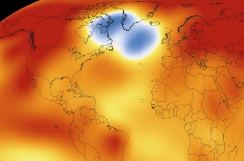
New Scientist recently reported on a mysterious “cold blob” in the Atlantic that suggests the AMOC is weakening. The paywalled article states: A patch of ocean south-east of Greenland is the only place on Earth that is cooling, and it could be a sign that the warm water “conveyor belt” in the Atlantic is slowing down.
Goddard Space Flight Center
Kent Moore, a professor of atmospheric physics at the University of Toronto, said the effects of an AMOC slowdown would also be felt in Canada.
“If the AMOC weakens, the predictions are that sea level will rise along the east coast of Canada, by maybe 25 centimetres,” he said, adding that he is also worried about the geopolitical fallout of people moving to warmer climates or away from coasts.
According to an AI Overview, a slowing AMOC would severely impact Canada in other ways:
- Agricultural Volatility: Disrupted global heat and ocean patterns increase weather extremes. Canadian farmers could see highly volatile spring seasons where sudden, unseasonable cold air outbreaks destroy early crop blossoms and harvests.
- Disrupted Marine Ecosystems: The AMOC delivers essential nutrients to northern oceans. A weakened current would reduce primary productivity in the North Atlantic, threatening plankton populations and disrupting vital regional fisheries (such as tuna and pilot whales).
- Atmospheric Circulation Changes: While Europe faces the brunt of the cooling from the missing warm currents, shifting tropical rain belts would alter global precipitation — potentially worsening drought patterns in parts of North America.
The climate and mining
Whether the Canadian climate becomes drier due to an El Nino, a Super El Nino, or an AMOC slowdown, the effects will be felt by the mining industry, which is highly dependent on a steady water supply for mineral processing and often, hydroelectric power. Moreover, operations can be, and have been, interrupted by forest fires.
Another AI Overview states that droughts severely impact Canadian mining operations by triggering critical water shortages for mineral processing, forcing production curtailments to meet strict dust-suppression regulations, and increasing the risk of acid rock drainage. Low water levels also disrupt supply chains by limiting shipping loads and restricting hydroelectricity access.
The effects of drought on the Canadian mining sector manifest in several specific ways:
- Processing Water Shortages: Mining operations—especially open-pit copper, gold, and coal mines—require vast amounts of water for mineral processing and dust suppression. In regions like British Columbia and the Prairies, prolonged droughts and shrinking snowpacks limit industrial water access, sometimes forcing mines to cut back production or seek expensive alternative water sources.
- Environmental & Tailings Management: Droughts and high temperatures alter the hydrological balance of mine sites. A lack of moisture can increase the oxidation of stored waste rock and tailings, exacerbating the severity of Acid Mine Drainage (AMD) when re-wetting occurs. Reduced water levels also threaten the “wet covers” used by some mines to suppress toxic runoff.
- Energy Interruptions: Canada’s heavy reliance on hydroelectricity means drought conditions reduce power generation capabilities. This leads to spikes in electricity costs and occasional grid rationing, directly raising operational expenses for power-intensive mining facilities.
- Supply Chain and Shipping Constraints: Low water levels in major transport corridors — such as reduced levels in the Great Lakes —limit shipping capacity, forcing operators to carry lighter, less efficient loads of extracted metals and non-metals.
Conclusion
This Thursday, forecasters from the National Oceanic and Atmospheric Administration are expected to officially declare that an El Nino is underway.
The World Meteorological Association said on June 2 that there’s an 80% probability of an El Nino event starting this summer, and a 90% chance it will continue until at least November.
Previous El Ninos extended well into the following year; the 2026 “Little Boy” is probably not going to be an exception. In fact, this year’s El Nino is likely to become a Super El Nino, with computer models suggesting the North Pacific Ocean could warm by over 5 degrees Fahrenheit, more than the 3.6 degrees F that classifies a Super El Nino.
The elevated temperatures and dry conditions from the winter often spill over into the following year’s summer. In 2027, Western Canada and Northern Canada face higher potentials for early heatwaves, severe drought, and compounded wildfire risks.
If we believe the most recent studies, we have about 75 years to go before the Atlantic Meridional Overturning Circulation stops moving.
The upshot from the research is that the AMOC tipping point is closer than previously thought. When the current slows and eventually stops, it will cause abrupt climate changes especially to northern Europe and Canada.
Among the likely effects are a rapid cooling of northern Europe in winter, and hotter, drier summers. In Canada it could mean up to 25 centimeters (about 10 inches) of sea-level rise along the east coast — enough to cause flooding.
This is before the melting of the Greenland ice cap. If the entire ice sheet were to melt completely, it would raise global seal levels by about 7.4 meters, or 23 feet. Entire cities would be underwater.
Growing seasons will become more unpredictable, with cold snaps happening more frequently, blighting or destroying crops.
A weakened current would threaten plankton populations and disrupt vital regional fisheries such as tuna and pilot whales.
There is little we can do to stop any of this from happening. The Earth will keep warming up until it naturally cools, as it has done for millenia.
The best course of action is to stay ahead of the changes by hardening infrastructure located close to ocean shorelines, build sea walls higher, and not allow the construction of any new residential or commercial building close to vulnerable areas.
Ongoing droughts are harder to handle. They require careful rationing of water supplies to allow farms to be irrigated and for drinking water and sanitation. We’re heading towards a world where there is more competition for water and other scarce resources.
Richard (Rick) Mills
aheadoftheherd.com

Legal Notice / Disclaimer
Ahead of the Herd newsletter, aheadoftheherd.com, hereafter known as AOTH.Please read the entire Disclaimer carefully before you use this website or read the newsletter. If you do not agree to all the AOTH/Richard Mills Disclaimer, do not access/read this website/newsletter/article, or any of its pages. By reading/using this AOTH/Richard Mills website/newsletter/article, and whether you actually read this Disclaimer, you are deemed to have accepted it.


