What’s with all the weird weather?

2019.07.17
In January 2018, something strange happened in the Sahara Desert: it snowed. The Algerian town of Ain Sefra, named the “Gateway to the Sahara”, reportedly received up to an inch, barely enough to get the average North American out of bed early to scrape the car, but for North Africans, the outlier snowfall would have been magical; it was only the third time in 40 years that the Sahara Desert, one of the hottest places on earth, has received snow. (the desert gets very cold at night but even if it dips below freezing, any precipitation that crystallizes to snow usually melts right away)
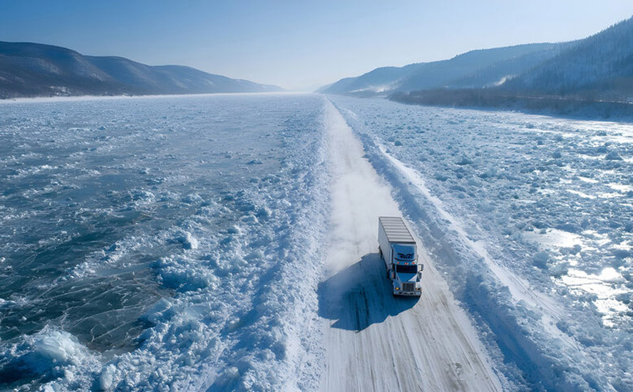
A year later, extreme heat and cold were experienced in Australia and Russia. Temperatures at Port Augusta, South Australia, shot up to 49 degrees Celsius, on the same day, Jan. 7, as the mercury plunged to -56 in parts of Russia. That’s numbingly cold, but not as bone-chilling as in January 2018, when a blast of -67 cold air hit Russia’s remote Yakuta region – low enough to freeze eyelashes.
Can these outlier weather events be explained by climate change?
Global warming theory posits that higher temperatures are bringing more extreme weather and more frequent, high-intensity storms. Last summer in British Columbia, more of BC was burned by wildfires than any previous summer. Heat records were set in the United Kingdom, northern Siberia, the eastern two-thirds of the United States and southeastern Canada.
The hottest temperature ever measured, 51.3 degrees C, was in Ouargla, Algeria, in July 2018, shattering the previous record of 50.7C set in 1961 in Morocco.
This summer has only just begun in the northern hemisphere, but already records are falling and residents are drooping from the relentless heat.
European scorcher
Few could have missed the headlines about the early-summer heat wave that blanketed most of Europe in June.
According to the EU’s satellite agency, Copernicus Climate Change Service, last month was officially the hottest June ever recorded. The data showed that, while the average global temperature rose by just 0.1 degrees Celsius, compared to June 2016, the last record – in Europe, temperatures soared.
The heat wave on the continent meant temperatures of 2C above normal, but in France, Germany and Spain, the thermometer climbed to between 6 and 10 degrees higher than normal, in the last few days of the month.
Records were blasted through in France (45C), Germany, Poland and the Czech Republic. In Spain, the 40+-degree temperatures set forests ablaze, burning at least 4,000 hectares. It reached 39 in Turin, Italy, 39 in Zarazoga, Spain, and 39 also in Avignon, France, a city normally known for its gentle Mediterranean climate.
The four-day heat wave was intense enough to kill seven people. It also led to flash floods, grounded planes, buckled train tracks, closed schools, initiated warnings over air quality, and triggered water restrictions that affected farmers and their crops – including widespread damage to grapes grown to make wine in southwestern France.
Meteorologists blamed the dangerously hot weather on a weakening of the jet stream, pushing super-heated air from Africa up to Europe. CBC reported that five of Europe’s hottest summers of the last 500 years happened in the 21st century, and quoted the World Meteorological Organization saying that the heat wave was “absolutely consistent” with the extreme weather linked to the impact of greenhouse gas emissions. Or was it? More on that below. Also remember, the heat wave of 2003 in Europe, which marked the hottest August on record, was many times worse than this past June – 35,000 people died!
But for now, let’s keep going on what has already been a wacky summer, weather-wise.
Perma-melt
A recent scientific report found that Canada is warming twice as fast as the rest of the world. Even worse is what’s happening in the Arctic, where the temperature has risen 2.3 degrees C compared to 70 years ago. Add another degree of warming during winter, states the report from Environment and Climate Change Canada.
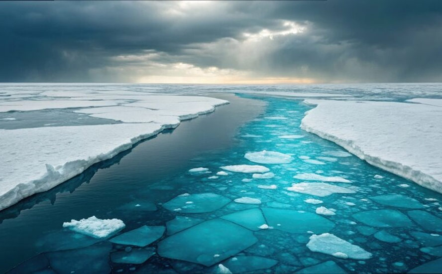
That has left southern Canadians with more rain in winter, and northern Canadians with melting permafrost and less sea ice.
When sea ice is lost, the sunlight is no longer reflected back to the atmosphere, but rather gets absorbed into the open ocean. This exacerbates ocean warming, and forms a warming cycle. Warmer water temperatures delay the growth of ice in fall and winter, and the ice melts faster in the spring, exposing patches of open ocean for longer periods during summer, and further warming the ocean.
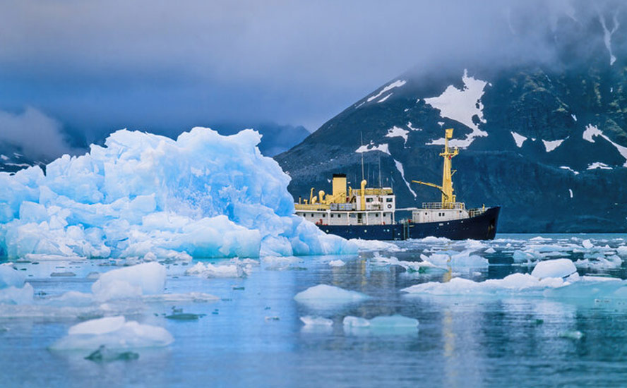
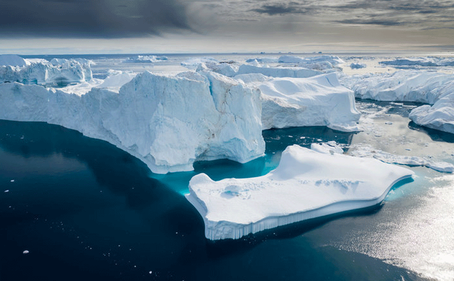
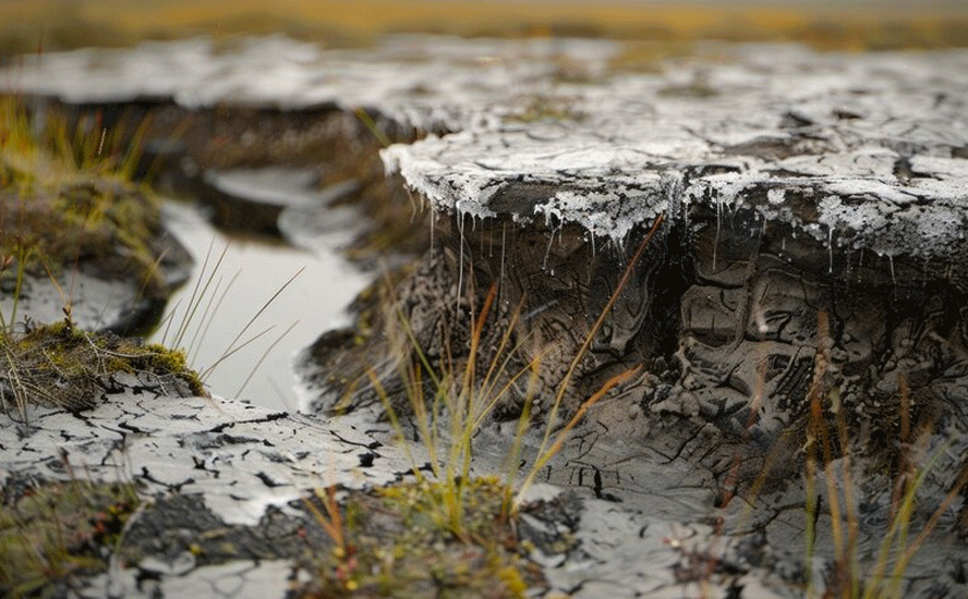
Along with calving glaciers, shrinking ice caps and disappearing sea ice, evidence of Arctic warming can also be seen in the thawing of permafrost. Arctic permafrost in 2017 reached record warm temperatures. Over the past 30 years, the Arctic has warmed more than any other region on earth.
A scientific team from the University of Alaska, Fairbanks, found that permafrost at outposts in the Canadian Arctic is thawing 70 years earlier than predicted.
“What we saw was amazing,” Vladimir Romanovsky, a professor of geophysics at the university, told Reuters. “It’s an indication that the climate is now warmer than at any time in the last 5,000 or more years.”
As the Arctic tundra thaws, it exposes methane, a greenhouse gas that is about 30 times more powerful than CO2, in terms of its ability to trap heat. This creates a feedback loop, which accelerates warming.
A feedback loop is what happens when one change causes another change to occur, worsening the first change. NASA states that climate feedbacks could double the amount of warming caused by carbon dioxide alone. States NASA:
The impact of climate change on the land carbon cycle is extremely complex, but on balance, land carbon sinks will become less efficient as plants reach saturation, where they can no longer take up additional carbon dioxide, and other limitations on growth occur, and as land starts to add more carbon to the atmosphere from warming soil, fires, and insect infestations. This will result in a faster increase in atmospheric carbon dioxide and more rapid global warming.
Read more at Climate Armageddon – Part 5
The photo below of a dog team splashing through a body of water atop a thin layer of ice that melted too early, is a powerful image of climate change in action. The shot was taken in northwest Greenland by Steffen Olsen, a climate scientist at the Danish Meteorological Institute, and published by The Weather Network.
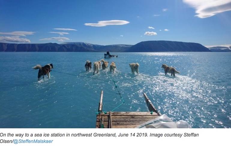
The institute reported in May that the spring melt began a month earlier than normal in 40% of the huge Arctic land mass, “adding up to an estimated 2 gigatons of ice lost in a single day.”

Flooded out
Across the Atlantic, problems of a different nature were mounting in May.
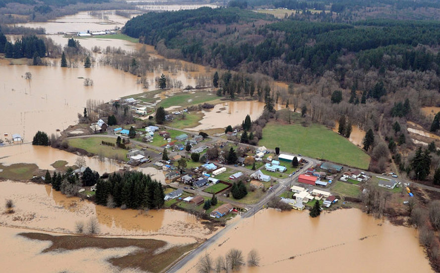
We’re talking about long and intense deluges, causing widespread flooding.
The central US and southeast were the worst-hit areas, with cities from Minneapolis to New Orleans slammed by heavy rains and cresting rivers.
CNN reported May 30 that some 70 river gauges along the Mississippi and its tributaries were experiencing major flooding, with another 104 showing moderate flooding. At one point over 100 million people were on flood watch from Oklahoma into Kansas, Missouri and Illinois.
The Mississippi River rose to 46.02 feet at St. Louis, the second highest crest in history, just beneath the record set in 1993.
According to AccuWeather, one storm after another bashed into the region during much of March, April and May: The storms packed a great deal of Pacific and subtropical moisture. May 2019 went down as the wettest on record for Nebraska, Kansas and Missouri, and Oklahoma recorded its second wettest May ever.
The weather news site notes that until the rains arrived, parts of the southeast were facing a sudden drought due to a dome of sinking air that produced extreme heat and dry conditions into late May. It attributed this phenomenon to El Nino, the episodic periods during which the waters over the tropical Pacific Ocean help to boost the intensity of storms in the southern United States.
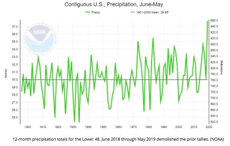
However AccuWeather also points to the extremely wet May, over two inches more precipitation than prior records set during strong El Nino winters, as evidence something else was happening – climate change:
While it is likely that the weak El Niño is intensifying rainfall over the Lower 48, increases in heavy rain events are also among the most anticipated and well-documented impacts from climate change.
May was characterized by warm extremes in the Southeast and simultaneously cold extremes in the north-central region. Such a contrasting pattern, which may become more common in a warming world, breeds storminess.
High snow pack
As southerners were hunkering down against slashing rain, high winds, tornadoes (between May 1 and 23, 340 spun across the United States, compared to a May average of 276) and swollen creeks/ rivers, farther north the snow was still flying.
In Colorado this past winter, it was cold. Along Colorado’s Front Range, three inches of snow fell in May. That day, the temperature in Denver only reached a high of 39 degrees F – the coldest the Mile High city has been in 128 years.
A higher than normal snowpack in the Rocky Mountains is likely to boost water levels in the drought-prone Colorado Watershed, in 2020.
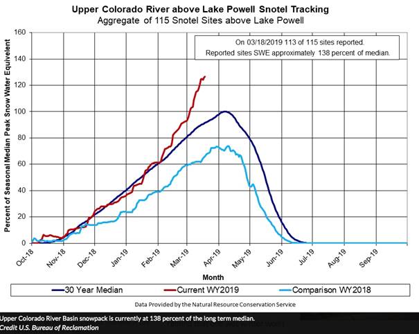
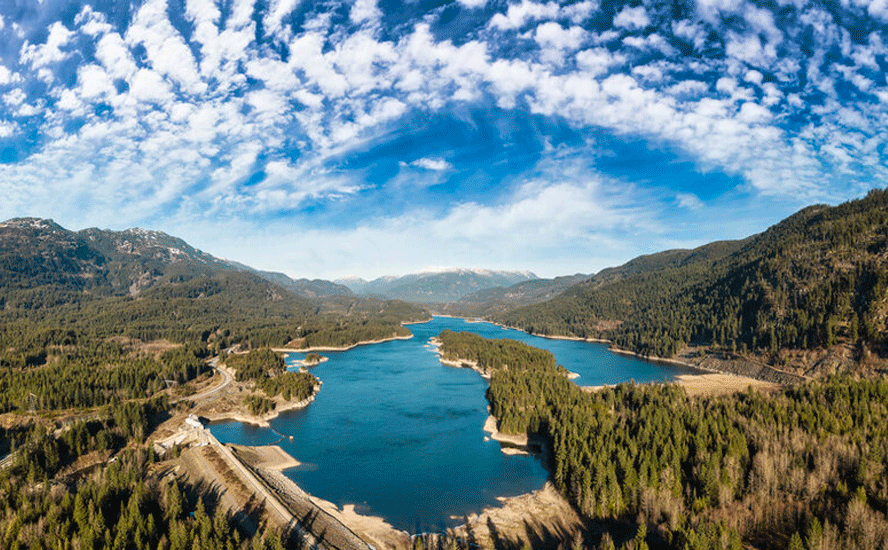
Data from the US Bureau of Reclamation states shows the snowpack in the Upper Colorado River Basin at 138% of the long-term median. The amount of snow hasn’t been that high in mid-March since 1997, and is good news for residents and businesses who rely on the Lake Mead reservoir – America’s largest store of fresh water – for their drinking water and irrigation needs.
Although, as federal officials warn, one wet winter is unlikely to solve the southwest’s water problems; Lake Mead is projected to be just five feet higher than 1,075 feet at the end of this year, the level deemed to indicate a shortage.
The blob off BC
El Nino may have been partially responsible for the wild US weather in recent months. Up north in the temperate Pacific Northwest, our unseasonably warm weather also has climate and weather watchers scratching their heads.
Turns out the mild winter we had in British Columbia was owing to something called “the blob”. The blob is a huge mass of Pacific Ocean warm water that parks itself off the coasts of BC, Washington State and Oregon, bringing a steady pattern of mild weather throughout the winter months. It was reportedly first noticed in 2014, re-appeared in 2016 and most recently, last fall.
True to form, this past winter has been warmer than usual, and it continued into March, breaking temperature records like a board of falling dominoes. In mid-March, Squamish and Agassiz both hit 25.9 degrees C, smashing records set in 1999 and 1960, respectively, during weather more suited to summer.
More records were broken in May during a summer-like warm spell that saw multiple high-temperature records broken, including Victoria and Squamish.
Wandering polar jet stream
To sum up, we have multiple anomalous weather patterns emerging unevenly throughout the earth, but occurring around the same time.
The big question is, why?
To understand this we need to begin with the jet stream, a band of air that flows like a river around the Arctic from west to east. Cold air is generally kept in latitudes above the jet stream, and warm air below it.
The swirling bands of jet stream air that influence weather in North America and Europe, create a pattern known as “Rossby waves”.
These waves help to move heat from the tropics toward the poles, and cold air to the tropics, thereby keeping temperatures moderate. When the temperature difference between the higher and lower latitudes is great, the Rossby waves flow in a relatively straight line with little meandering. When the waves meander, causing more pronounced dips and bulges, weather events occur, at the intersection of warm and cold air masses.
Now factor in the warming poles due to climate change. Because the Arctic is warming faster than the rest of the planet, the jet stream is thrown off course, with increasing frequency of meandering pockets of air, which create stormy weather.
This is particularly so when disruptions in the polar vortex come into contact with the meandering Rossby waves flowing over North America.
The polar vortex is a seasonal atmospheric phenomenon whereby high winds swirl around an extremely cold pocket of Arctic or Antarctic air. The winds are like a barrier that contains the cold air, but when the vortex weakens, the cold air “escapes” from the vortex and travels south, bringing with it a cold blast of Arctic weather. An example of such weakening occurred in 1985 when the northern polar vortex became so distorted that cold air pushed down as far as Florida, destroying the normally balmy state’s orange crop. During the winter of 2018, the northern polar vortex stretched its icy fingers towards Eurasia, which saw temperatures plummet to -80° Fahrenheit (-62C) in Siberia.
How does climate change affect the polar vortices? The answer is warming oceans. As more ice melts during the summer, the Arctic Ocean warms. The effect is less pronounced in Antarctica due to Antarctica being a land form, not a polar ice cap. That heat gets radiated back to the atmosphere in winter, which reduces the intensity of the northern polar vortex winds. The polar vortex gets disrupted, allowing cold air in the center of the swirling cyclone above the pole to migrate south. According to Scientific American, data taken from the past decade prior to 2016 shows that in years when a lot of Arctic sea ice disappeared, the vortex was more likely to weaken.
This past winter, the weakening polar vortex, made worse by more warm water allowed to escape into the atmosphere due to thinning Arctic sea ice, disrupted the polar vortex, “leading to enhanced waviness in the polar jet stream,” according to Judah Cohen, Director of Seasonal Forecasting at Atmospheric and Environmental Research.
This accounts for the wild weather in the United States from April through June, explains an article in Discover Magazine:
What’s going on? Cohen believes the cascade of events that has led to this month’s weather mayhem is tied to the shrinking lid of floating sea ice in the Arctic.
In particular, the autumn sea ice freeze-up has been occurring more slowly than it once did. Then in spring, break-up and melting of the ice has been happening earlier.
The result: The sea surface is now exposed to the air for longer than it once was. This allows warmth and water vapor to escape from the open waters into the atmosphere. Research has shown that this, in turn, can disrupt large-scale circulation patterns in the atmosphere — including the polar vortex.
This is exactly what happened in April, with disruption of the polar vortex leading to enhanced waviness in the polar jet stream, according to Cohen. Over Scandinavia, within one of the northward-pointing lobes of the wavy jet stream, a broad area of abnormally high pressure formed.
And there it sat, stuck in place, helping to reinforce the jet stream’s waviness in what meteorologists call a “blocking pattern.”
“I do think the wild weather that we have seen, with a highly amplified trough and the anomalous cold and snow, and even the severe weather upstream, is related to sea ice loss, a weakened polar vortex, the high latitude blocking, and a more amplified jet stream pattern across the U.S.,” Cohen says.
How about the extreme heat in Europe? The scientific evidence suggests the same phenomenon is likely responsible. In June the regular pattern of the jet stream changed, into the shape of the Greek letter omega, which resulted in warm, dry air being pulled north from Africa, and settling above Europe.
While the reasons for the changing pattern of the jet stream are still a focus of research, Evidence is accumulating that suggests large northward swings in the jet stream, like the one that is causing this heat wave, will occur more often in connection with a rapidly warming Arctic, [ABC News quotes Dr Jennifer Francis, senior scientist at the Woods Hole Research Centre USA].
The theory is that as the Arctic warms, the difference in temperature above and below the jet stream will lessen, causing the jet stream to slow and its flow to become more wiggly. Similar to how a slow flowing river has wider meanders than a fast one.
This would result in the jet stream swinging north more often to bring unusually high temperatures as well as swinging south to bring unusually cold temperatures.
Climate scientists also believe that the overall warming of the planet is more likely to cause warming situations such as the European heat wave. A study done after the 2018 heat wave in the UK, mentioned by ABC News, found the probability of a similar event was 30 times more likely than in 1750 when there was less concentration of greenhouse gases in the atmosphere.

The Independent quotes Peter Stott, an expert on climate change and extreme weather, saying that a similar heat wave 100 years ago would have been about 4 degrees cooler, because the baseline temperature was lower. In other words, because Europe’s average temperature has risen about 1.5C over the last century, suddenly adding a warming event makes temperatures spike higher than if the baseline temperature was cooler.
Heat waves therefore are likely to be amplified by a rise in global temperatures, due to heat-trapping greenhouse gases, and occur more often.
Richard (Rick) Mills
subscribe to my free newsletter
Ahead of the Herd Twitter
Ahead of the Herd FaceBook
Legal Notice / Disclaimer
This article is copyright protected and may not be reproduced in whole or in part or retransmitted or reposted without the authors written permission.
This document is not and should not be construed as an offer to sell or the solicitation of an offer to purchase or subscribe for any investment. Richard Mills has based this document on information obtained from sources he believes to be reliable but which has not been independently verified. Richard Mills makes no guarantee, representation or warranty and accepts no responsibility or liability as
to its accuracy or completeness. Expressions of opinion are those of Richard Mills only and are subject to change without notice. Richard Mills assumes no warranty, liability or guarantee for the current relevance, correctness or completeness of any information provided within this Report and will not be held liable for the consequence of reliance upon any opinion or statement contained herein or any omission. Furthermore, I, Richard Mills, assume no liability for any direct or indirect loss or damage or, in particular, for lost profit, which you may incur as a result of the use and existence of the information provided within this Report.
Legal Notice / Disclaimer
Ahead of the Herd newsletter, aheadoftheherd.com, hereafter known as AOTH.Please read the entire Disclaimer carefully before you use this website or read the newsletter. If you do not agree to all the AOTH/Richard Mills Disclaimer, do not access/read this website/newsletter/article, or any of its pages. By reading/using this AOTH/Richard Mills website/newsletter/article, and whether you actually read this Disclaimer, you are deemed to have accepted it.
