2023 shaping up to be hottest in 100,000 years – Richard Mills
2023.07.12
Last week in North Grenville, Ontario, the city turned hockey rinks into cooling centers as temperatures hit 32 degrees Celsius and it felt like 38 with the humidity.
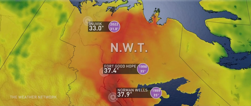
Heat warnings were issued in British Columbia from the north to central coast and in the Fraser Valley east of Vancouver. A similar warning was in place for parts of the Northwest Territories, with Fort Good Hope and Norman Wells setting new heat records over the weekend, of 37.4 and 37.9 degrees, respectively.
Both communities lie just south of the Arctic Circle. Inuvik hit a high of 33, besting its 2022 record by 1.2 degrees.
The National Weather Service in the United States issued multiple heat advisories, amid hospitalizations in Austin and San Antonio, Texas, as temperature records tumbled in Portland, Tampa and El Paso.
At the end of June, 11 people died in one Texas county as the mercury blasted past triple digits in Fahrenheit. The heat extended to Mexico where at least 112 people have expired since March.
China is facing one of its most brutal heat waves at +40 degrees, while in India, parts of the north have been sweltering. Hundreds were sickened by heat-related diseases in Uttar Pradash after temperatures reached 47, adding to the misery of nearly half a million in the country’s northeast affected by severe flooding and landslides.
In Ukraine, Turkey and Spain, people sought relief from the scorching sun by diving into bodies of water.
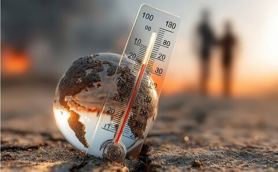
The fact that so many parts of the world are simultaneously hitting record-high temperatures is unprecedented.
According to data from the University of Maine’s Climate Reanalyzer, a new daily global record of 62.9 degrees Fahrenheit, or 17.18 Celsius, was set on July 6. Last Thursday’s high surpassed a daily high reached two days before.
It was also the hottest week on record, with the Climate Reanalyzer finding that for the seven-day period ending last Wednesday, the average daily temperature was .08 degrees Fahrenheit (.04 C) warmer than any week in 44 years of record-keeping.
While the records are based on data that only go back to the mid-20th century, a senior climate scientist at Woodwell Climate Research Center quoted by one media outlet said they are “almost certainly” the warmest the planet has seen over a much longer time period – “probably going back at least 100,000 years.”
The same climate scientists are saying the heat is set to continue as the planet keeps warming. “A record like this is another piece of evidence for the now massively supported proposition that global warming is pushing us into a hotter future,” Stanford University’s Chris Field commented last week.
Reasons why
We already know that last month was Earth’s hottest June on record by a “substantial margin,” according to the European Union’s Copernicus Climate Change Service, or half a degree warmer than a typical June.
The agency found the nine hottest Junes have all occurred in the last nine years, with the previous record set in 2019.
Copernicus attributes the phenomenon to an extreme heat wave that blanketed the southern United States and Mexico, combined with ocean temperatures soaring to alarming levels.
NOAA, the National Oceanic and Atmospheric Administration, reported in June that surface temperatures in the North Atlantic were up to 5 degrees C warmer than usual. The same thing is happening in Antarctica, where scientists have linked warm waters off the Indian, Pacific and Atlantic oceans to plunging sea ice levels.

Source: Climate Change Institute/ University of Maine
The Globe and Mail said parts of the continent and nearby ocean were 10 to 20 degrees Celsius higher than averages from 1979 to 2000.
NOAA predicts marine heat waves will increase from covering 40% of the world’s oceans to 50% later this summer.
Another related climate phenomenon that is behind the record heat, is the switch from “La Nina” to “El Nino”.
It’s been well-established that warmer, or colder-than-average ocean temperatures have an influence on weather. According to the NOAA, El Nino causes the Pacific jet stream to move south and spread further east. During winter, this leads to wetter conditions than usual in the southern US and warmer and drier conditions in the north.

El Nino is shorter-lived than La Nina, usually lasting nine months to a year versus a few years for the cooling phenomenon. El Nino is said to be warming up the eastern Pacific Ocean, and is forecast to intensify and linger to at least the end of the year, resulting in higher global temperatures. The World Meteorological Organization officially confirmed the arrival of El Nino last Wednesday, July 5.
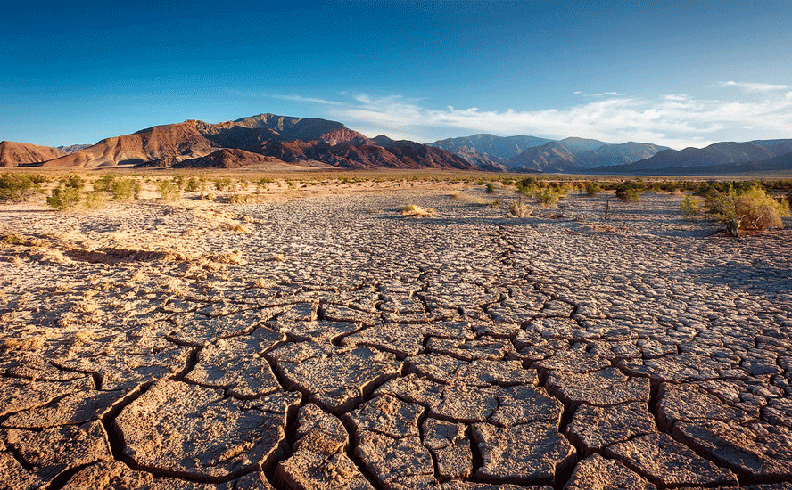
Most forecasters believe that, with El Nino kicking in across the Pacific Ocean, Western Canada could be dry for months, possibly even approaching the parched conditions the southwestern United States has been experiencing for the last 20-odd years.
According to U.S. Drought Monitor, To the south and west, in southern Missouri, the Texas-Louisiana border and other parts of central Texas, drier weather led to worsening precipitation deficits, and significant problems with hay production in parts of southern Missouri. Dry weather in the Upper Midwest led to further degrading conditions in parts of Michigan, Wisconsin and Minnesota.
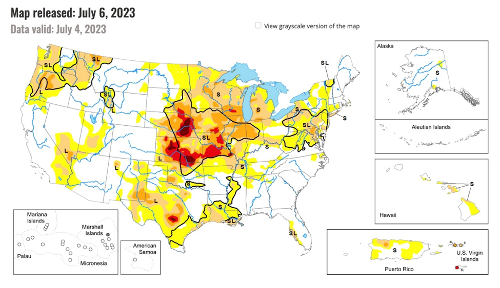
Areas in red are extreme drought, purple is exceptional drought, orange is severe drought, brown is moderate drought, and yellow is abnormally dry. Source: U.S. Drought Monitor
In Canada, 60% of the country at the end of June was classified as abnormally dry, or in moderate to extreme drought, including three-quarters of agricultural land. Central BC and southern Alberta saw the greatest degree of drought degradation.

Aside from El Nino and La Nina, weather in Canada is largely influenced by the jet stream, a narrow band of winds that swirl about 10 kilometers above the Earth. Because the winds are so strong, between 160 and 320 km/h, they push low- and high-pressure systems across the country, often dictating temperature and precipitation.
When El Nino is brought into the picture, it can strongly impact the jet stream, causing different weather patterns across Canada.
According to the National Oceanic and Atmospheric Association (NOAA), via CTV News, when the jet stream is under El Nino conditions, it makes northern areas like Canada dryer and warmer than usual.
Depending on the strength of the heat, some areas will receive more precipitation while others could face severe drought, the media outlet quoted Richard Dewey, associate director of science with Ocean Networks Canada.
That’s because when warmer air from El Nino presses into the country, it creates what is called an Omega blocking pattern in the jet stream.
“On the backside of an Omega blocking pattern, you have a big depression of the polar air, so cold air is much deeper south than normal,” Dewey said. “And sometimes these patterns just sit there for a long time.”
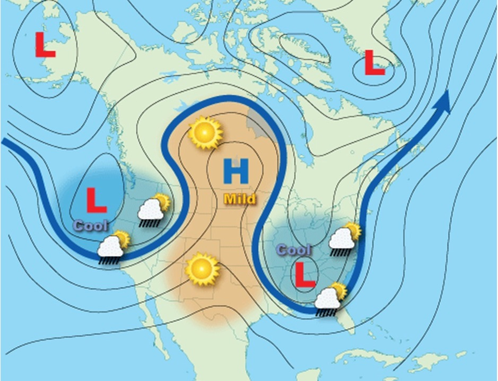
According to an article from NASA, at the time of the Fort McMurray fires in 2016, hot, dry weather was sitting over Alberta in the Omega blocking pattern.
Warmest year ever?
Between El Nino and continued global warming, 2023 is likely to be the hottest year on record. Via CNN, a Berkeley Earth analysis in May put the chances of this happening at 54%. But with June already breaking the heat record, those odds are likely to increase.
The temperature over the global land and ocean would have to exceed 58.69 degrees F, set in 2016, the last El Nino year.
“It is actually almost a certainty that this will be the warmest year globally,” Michael Mann, a climate scientist and professor at the University of Pennsylvania, told USA Today. “We can expect that combination of factors to supercharge weather events this summer in the form of extreme heat waves, drought, wildfire and flooding events.”
Conclusion
Looking further into the future, it seems very likely that extreme heat, with its accompanying droughts, fires and famines, will get worse.
The United Nations’ World Meteorological Organization said in May, via The Globe and Mail, that there is a 98% likelihood that one of the next five years, or the five-year period as a whole, will be the warmest on record.
In 2018, the UN Intergovernmental Panel on Climate Change (IPCC) warned that the effects of global warming would be irreversible in 12 years. Seven years before the deadline, climate scientists are already saying, “we told you so.”
Peter Stott, a science fellow in climate attribution at the UK’s Met Office, recently said that seeing climate change unfold in front of us is terrifying because “this will just carry on getting worse and worse, and more and more extreme. So what we’re seeing now is only a foretaste of what could happen if efforts to reduce emissions aren’t successful.”
The canary in the coal mine? Warm records are being broken more often. According to USA Today, the normal bell curve of weather records — where the most frequently observed temperatures occur along the peak of the curve — has shifted to the right. Weather stations across the globe are reporting average temperatures have increased, as has the frequency of new warm records. Rainfall records are also being set more often.
Richard (Rick) Mills
aheadoftheherd.com
subscribe to my free newsletter
Legal Notice / Disclaimer
Ahead of the Herd newsletter, aheadoftheherd.com, hereafter known as AOTH.
Please read the entire Disclaimer carefully before you use this website or read the newsletter. If you do not agree to all the AOTH/Richard Mills Disclaimer, do not access/read this website/newsletter/article, or any of its pages. By reading/using this AOTH/Richard Mills website/newsletter/article, and whether you actually read this Disclaimer, you are deemed to have accepted it.
Any AOTH/Richard Mills document is not, and should not be, construed as an offer to sell or the solicitation of an offer to purchase or subscribe for any investment.
AOTH/Richard Mills has based this document on information obtained from sources he believes to be reliable, but which has not been independently verified.
AOTH/Richard Mills makes no guarantee, representation or warranty and accepts no responsibility or liability as to its accuracy or completeness.
Expressions of opinion are those of AOTH/Richard Mills only and are subject to change without notice.
AOTH/Richard Mills assumes no warranty, liability or guarantee for the current relevance, correctness or completeness of any information provided within this Report and will not be held liable for the consequence of reliance upon any opinion or statement contained herein or any omission.
Furthermore, AOTH/Richard Mills assumes no liability for any direct or indirect loss or damage for lost profit, which you may incur as a result of the use and existence of the information provided within this AOTH/Richard Mills Report.
You agree that by reading AOTH/Richard Mills articles, you are acting at your OWN RISK. In no event should AOTH/Richard Mills liable for any direct or indirect trading losses caused by any information contained in AOTH/Richard Mills articles. Information in AOTH/Richard Mills articles is not an offer to sell or a solicitation of an offer to buy any security. AOTH/Richard Mills is not suggesting the transacting of any financial instruments.
Our publications are not a recommendation to buy or sell a security – no information posted on this site is to be considered investment advice or a recommendation to do anything involving finance or money aside from performing your own due diligence and consulting with your personal registered broker/financial advisor.
AOTH/Richard Mills recommends that before investing in any securities, you consult with a professional financial planner or advisor, and that you should conduct a complete and independent investigation before investing in any security after prudent consideration of all pertinent risks. Ahead of the Herd is not a registered broker, dealer, analyst, or advisor. We hold no investment licenses and may not sell, offer to sell, or offer to buy any security.
Legal Notice / Disclaimer
Ahead of the Herd newsletter, aheadoftheherd.com, hereafter known as AOTH.Please read the entire Disclaimer carefully before you use this website or read the newsletter. If you do not agree to all the AOTH/Richard Mills Disclaimer, do not access/read this website/newsletter/article, or any of its pages. By reading/using this AOTH/Richard Mills website/newsletter/article, and whether you actually read this Disclaimer, you are deemed to have accepted it.


