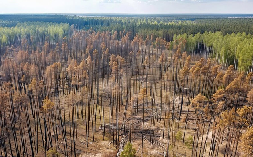
Early-summer heat dome bakes Eastern Canada and the US – Richard Mills
2024.06.21
Thursday marks the first day of summer, but depending on where you live, it will either be just another day or one of the hottest of the year.
Paraphrasing Dickens, The Weather Network reported “It’s a tale of different climates across Canada this week,” with those in Western Canada experiencing unseasonably cold weather, while people in Eastern Canada swelter under an early-summer heat dome.
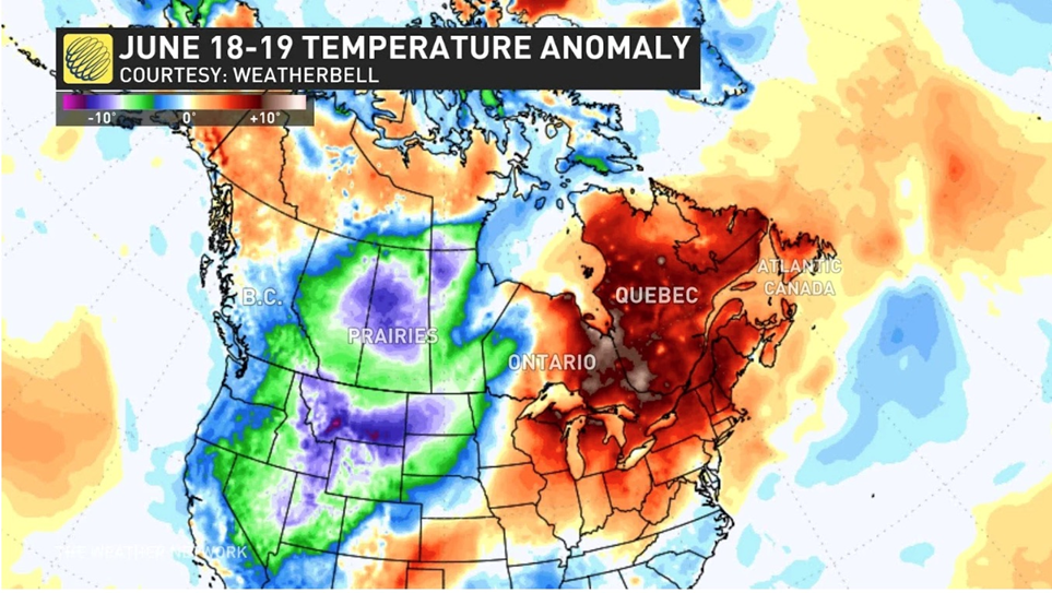

On Monday, June 17, a large cold front moved down from the Arctic and settled across British Columbia and the Prairies, bringing cold to the region. The next day, southern Alberta was hit with a surprise snowfall, as the overnight low in Canmore plunged to -7C.
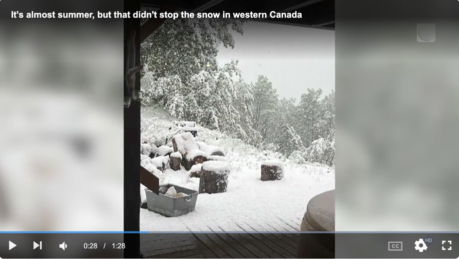
Calgary and Edmonton were expected to see temperatures 20 degrees below normal on Wednesday, at time of writing.
“The snowfall was quite heavy at times in places like Canmore, Banff and even Bragg Creek, however except for at higher elevations this snow and Old Man Winter weren’t sticking around,” said a Weather Network reporter. “We know the sun is very nearly at its annual high point in the sky that’s coming in just a few days with the summer solstice. That means we have a lot of solar radiation making its way down to the Earth, heating up surfaces and quickly eating away at whatever fell.”
Western Canadian temperatures are expected to level out by the end of the week.
Eastern heat dome
It’s a completely different set of conditions in Eastern Canada and the US Northeast and Midwest.
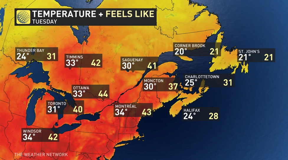
“Record-breaking humidex values will sweep across the region, bringing temperatures in the low-to-mid 30s range for much of southern Ontario, Quebec, and Atlantic Canada,” The Weather Network said. “The real danger will be the high humidex values. Toronto, Montreal, and Ottawa are looking at humidex values in the low-to-mid 40s for much of the week.
“Little relief will be felt at night as temperatures will only dip slightly to the mid 20s.”
A Global News report Tuesday said that with the extreme humidity it felt like 40 degrees in Montreal for the second day in a row. The city’s emergency protocols kick in when it’s 33 or above for three consecutive days, such as employees knocking on doors to check on people. A Montreal heat wave in 2018 killed 66.
In Ottawa with the humidity it was 44, triggering a warning by the city’s medical health officer that people should avoid strenuous outdoor activities.
A return to cooler weather isn’t expected until next week.
State-side, the same system has sent temperatures soaring.
According to CNN, around 270 million Americans will experience temperatures at or above 90 degrees Fahrenheit this week, as a massive heat dome parks itself across the eastern United States.
The National Weather Service’s Weather Prediction Center said parts of the Midwest to the Northeast could endure the longest heat wave they’ve seen in decades; multiple June high temperature records are expected to fall.
Wednesday and Thursday should be the hottest, with heat reaching dangerous levels in several major metropolitan areas including Chicago, St. Louis, Detroit, Cleveland, Pittsburgh, New York City and Boston.
The windy city hit a record-high 97 degrees Monday, topping the previous record of 96 set back in 1887. That’s 16 degrees above normal.
Meteorologists say it’s not only the high temperatures that are uncomfortable, but the humidity. According to CNN, Chicago residents could feel heat indices between 95 and 105 degrees through next week, while parts of eastern New York and western New England could see indices as high as 107 degrees.
Extreme heat is by far the deadliest form of severe weather, killing on average twice as many people a year as tornadoes and hurricanes combined, the news site noted.
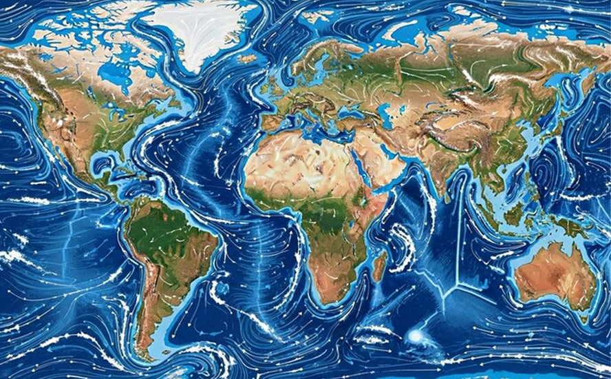
Heat domes occur when winds in the upper atmosphere, also known as the jet stream, are influenced by the ocean below. Hot seas cause the winds to shift, resulting in areas of high pressure that trap hot air in place for weeks.
In 2021, a heat dome that settled over western North America killed 619 people in BC alone, mostly seniors stuck in apartments or hotels with no air conditioning. In Lytton, British Columbia, Canada’s hot spot of 49.6C was recorded on June 29, 2021. The next day a wildfire completely destroyed the town.
Other extreme heat events took place in Europe in 2003 and India in 2015. In Europe an estimated 30,000 casualties were recorded amid temperatures hitting 104F in July and August that year. More than 2,000 people died in India when the mercury reached 118F. It was so hot in Delhi that roads started melting.
Get ready for extreme heat and its effects on crops, lives
Wet bulb temperature rating
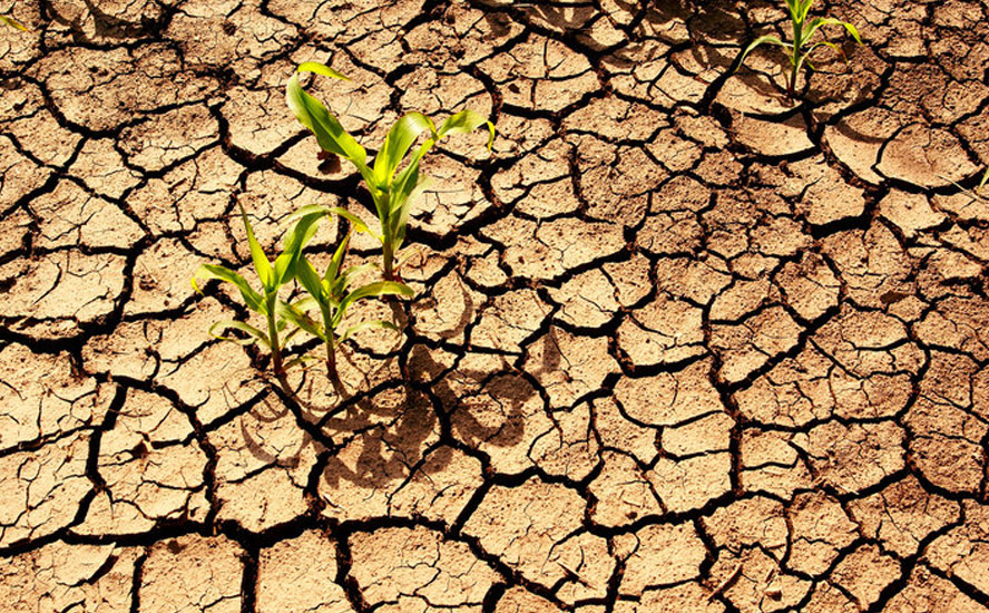
When temperatures are rising so fast that extreme heat becomes a common occurrence in several parts of the world including our own (Western Canada), plant growth is stunted, leading to lower crop yields and in worst cases, the destruction of the entire crop.
In a rapidly warming world, it’s worth considering what this means for human health.
People are generally comfortable living and working in temperatures up to about 26C. The heat index is what the temperature feels like when air temperature is combined with relative humidity. Between 26C and 32C, fatigue is possible with prolonged exposure and/or physical activity. From 32C to 39C, heat stroke, heat cramps or heat exhaustion are possible. The danger zone is entered @ temperatures between 39C and 51C, with extreme danger happening when it gets +125 F (51 Celsius) or higher.

In fact, our current heat measurements may be underestimating the dangers of extreme heat to the human body. Meteorologists are therefore turning to the “wet bulb globe temperature” for a more accurate reading.
Basically a more nuanced version of the heat index, the wet bulb globe temperature (WBGT) takes into account not only the air temp and humidity, but the wind speed, sun angle and solar radiation levels.
Between 26.6 and 31 degrees Celsisu WBGT, working in the sun for more than 45 minutes put the body under serious stress. About 31C WBGT, the window of safety closes to 20 minutes. Above 32C, being active in the heat becomes dangerous after 15 minutes, and reaches a point in the 30s where you shouldn’t be doing anything outside.
Warm, dry May
Cooler temperatures and rain over about a month-long period in May and June was a welcome reprieve in British Columbia and Alberta, which experienced a mild winter and low snowpack. Many fear a repeat of last summer’s droughts, water shortages and forest fires.
But climate scientists say it isn’t likely to dislodge the current drying trend, a holdover from the El Nino climate phenomenon that started in June 2023.
We are currently in the process of transitioning from El Nino to La Nina, but the change isn’t expected to happen until after the summer.
The transition could explain the unseasonably cold, wet conditions experienced at the end of May and early June across BC and Alberta.
However, the picture changes if we only look at May.
Month-end totals reported by Global News found that May was warmer and drier than normal across British Columbia, with some regions receiving less than half their monthly rainfall totals.
Vancouver had its ninth driest May, receiving a quarter of its regular rainfall, 16mm vs 65mm. Victoria got 31% of its normal rain, Kelowna was at 51% of normal, and Williams Lake received 101% less.

The statistics match what is happening globally. The Washington Post reported that May marked the 12th consecutive month during which average global temperatures surpassed observations since 1850.
The winter of 2024 saw record-breaking warmth globally, with Canada experiencing its hottest winter on record and Europe its warmest February and second-warmest winter.
Montreal had its second warmest winter since records began in 1871.
The role of global warming
Clearly, El Nino was behind the mild winter, but climate scientists say we shouldn’t discount the role of climate change.
Temperatures have been more than 1 degree C above pre-industrial levels for over a decade.
The last eight years have been the hottest on record, with 2023 the warmest ever. October 2023 hit a world heat record.
Last year’s average temperature was about 1.4C higher than the pre-industrial (1850-1900) era.
According to a 2022 study, global warming is expected to increase exposure to dangerous heat index levels by 50% to 100% in the tropics and by up to 10 times across most of the planet.
Where we stand
Forecasters say just because El Nino is weakening, doesn’t mean it will be any cooler this year.
The United Kingdom’s national weather service, the Met Office, expects the average global temperature in 2024 will be 1.34 to 1.58 C above average — marking the 11th straight year that temperatures will reach at least one degree above pre-industrial levels.
But while the summer will be warm, it probably won’t exceed 2023’s.
“Basing it on the El Niño at the beginning of the year, and then seeing how things are working out this year, it suggests that 2024 is going to be almost the same as 2023,” said Gavin Schmidt, director of NASA’s Goddard Institute for Space Studies in New York, via CBC News.
According to Agriculture Canada, drought conditions as of May 31 had improved throughout many regions of Canada due to increased precipitation in May. Moderate to Exceptional Drought (D1 to D4 on the map below) was 17% lower across Canada. However,
“At the end of the month, 45% of the country was classified as Abnormally Dry (D0) or in Moderate to Exceptional Drought (D1 to D4), including 59% of the country’s agricultural landscape.”

To me, this last paragraph is hardly reassuring.
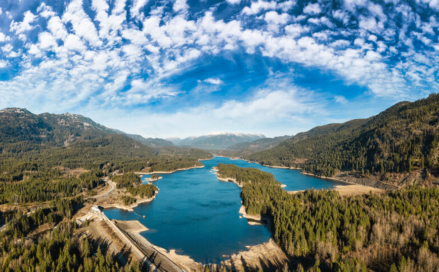
In mid-May the Canadian Space Agency provided satellite photos capturing images of BC’s dry riverbeds.
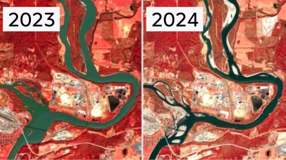
CBC News said The infrared images reflect what scientists on the ground have already been saying: water levels through the province’s Interior and north are alarmingly low…
Dave Campbell of the B.C. River Forecast Centre says with drought conditions dating back to 2022 and an average snowpack lower than has ever been recorded, there’s a high level of concern.
In a Global News story dated around the same time, Campbell said he’s especially worried about the effects of drought on smaller rivers and creeks in the central Interior, areas like Prince George, Quesnel, Williams Lake and Vanderhoof.
He noted it would take “a few months of wet-season rainfall” to ease the drought.
Fast forward six weeks, and we see the situation somewhat improved.
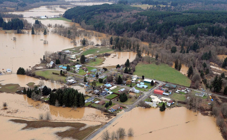
The Provincial Freshet and Flood Status summary says cooler temperatures in May led to a moderated snow melt season. The current snowpack as of June 1 is 57% of normal compared to a 63% average in April. Many of the larger watersheds are into peak freshet season; no flood hazard is currently anticipated.
On the other hand, while recent rainfall has increased flows in parts of the Interior, low snowpack and long-term precipitation deficits continue to keep water levels low, the status sheet warns.
Drought conditions in the United States are better than usual for this time of year. According to Drought.gov, the week of June 5-11 brought improvements in Kansas and New Mexico, two states that still have large areas of drought. The Midwest is now drought-free.
The June 4 map provided by the U.S. Drought Monitor shows Moderate to Exceptional Drought covering 10.2% of the United States, a slight decrease from last week’s 10.5%. The worst drought categories (Extreme to Exceptional) stayed about the same as last week’s 0.6%.


At the beginning of April, Successful Farming reported the US drought area was the smallest since May 2020.
Less dry conditions are also improving the wildfire situation in Canada and the United States, including hard-hit British Columbia, which this time last year, had spiraled out of control. A Provincial Wildfire Status Update from June 19, 2023 showed 871,573 hectares had burned YTD, compared to a 10-year average of 21,734 ha.
It started out badly.
In mid-May, forest fires in Fort McMurray, Alberta and Fort Nelson, BC forced thousands of residents to evacuate. Thick smoke descended on large parts of Western Canada including Edmonton and Winnipeg, diminishing air quality.
The problem was little rain and snow falling over the winter, meaning watersheds never had a chance to replenish. According to the BC Wildfire Service, there were 112 active wildfires as of May 29, 2024.
Then came the rains.
As of June 12, the National Wildland Fire Situation Report says there are currently no wildfires of note and that Canada is at national preparedness level 1, indicating wildfire activity is minimal. The number of fires is well below average for this time of year and well below the 10-year average for area burned by this point in the year.
The exception is British Columbia, which is at agency preparedness level 3. All other jurisdictions are at levels 2 or 1.
Digging into the data, we find in British Columbia there are open burning restrictions across the Cariboo, Coastal, Kamloops, Prince George and Southeast regions. Alberta has fire bans and restrictions in the northwest and foothills regions of the province, as well as in and around Calgary. The Northwest Territories has extreme fire danger in the South Slave, Dehcho, North Slave, and Sahtu regions. In the Yukon fire danger is high around Dawson, Haines Junction and north of Whitehorse. Saskatchewan has fire bans and restrictions in the northwest region of the province. Manitoba has burning restrictions east of Flin Flon, and south-central regions. Quebec has a prohibition on open fires in the Nord-du-Québec, Côte-Nord, and Saguenay–Lac-Saint-Jean areas. Nova Scotia has fire restrictions across the entire province. Prince Edward Island requires burning permits based on the daily Fire Weather Index.
Only three provinces have no restrictions currently in place: Ontario, New Brunswick, Newfoundland and Labrador.
The report says drought is still a potential factor in many areas but especially northeast BC, northwest AB and southern NT. “A prolonged dry period in these regions could allow a resurgence of fire activity.”
State-side, the wildfire situation is mixed. According to the National Interagency Fire Center, 17 large, uncontained fires are currently being managed under full suppression, with another 11 being managed with strategies other than full suppression. So far this year, 19,034 wildfires have burned 2,128,208 acres, which is fewer fires but more acreage burnt than the 10-year averages.
California, Alaska and New Mexico currently have the most fires.

Conclusion
I am cautiously optimistic we will have a cooler summer than last year, amid the El Nino to La Nina shift, and less drought, wildfires and smoke. On the other hand, the pattern seems to be for dry, hot weather to continue year after year. It only takes a few weeks of heat, no rain and lightning for the situation to spin out of control like 2023, or worse.
Richard (Rick) Mills
aheadoftheherd.com
subscribe to my free newsletter
Legal Notice / Disclaimer
Ahead of the Herd newsletter, aheadoftheherd.com, hereafter known as AOTH.
Please read the entire Disclaimer carefully before you use this website or read the newsletter. If you do not agree to all the AOTH/Richard Mills Disclaimer, do not access/read this website/newsletter/article, or any of its pages. By reading/using this AOTH/Richard Mills website/newsletter/article, and whether you actually read this Disclaimer, you are deemed to have accepted it.
Any AOTH/Richard Mills document is not, and should not be, construed as an offer to sell or the solicitation of an offer to purchase or subscribe for any investment.
AOTH/Richard Mills has based this document on information obtained from sources he believes to be reliable, but which has not been independently verified.
AOTH/Richard Mills makes no guarantee, representation or warranty and accepts no responsibility or liability as to its accuracy or completeness.
Expressions of opinion are those of AOTH/Richard Mills only and are subject to change without notice.
AOTH/Richard Mills assumes no warranty, liability or guarantee for the current relevance, correctness or completeness of any information provided within this Report and will not be held liable for the consequence of reliance upon any opinion or statement contained herein or any omission.
Furthermore, AOTH/Richard Mills assumes no liability for any direct or indirect loss or damage for lost profit, which you may incur as a result of the use and existence of the information provided within this AOTH/Richard Mills Report.
You agree that by reading AOTH/Richard Mills articles, you are acting at your OWN RISK. In no event should AOTH/Richard Mills liable for any direct or indirect trading losses caused by any information contained in AOTH/Richard Mills articles. Information in AOTH/Richard Mills articles is not an offer to sell or a solicitation of an offer to buy any security. AOTH/Richard Mills is not suggesting the transacting of any financial instruments.
Our publications are not a recommendation to buy or sell a security – no information posted on this site is to be considered investment advice or a recommendation to do anything involving finance or money aside from performing your own due diligence and consulting with your personal registered broker/financial advisor.
AOTH/Richard Mills recommends that before investing in any securities, you consult with a professional financial planner or advisor, and that you should conduct a complete and independent investigation before investing in any security after prudent consideration of all pertinent risks. Ahead of the Herd is not a registered broker, dealer, analyst, or advisor. We hold no investment licenses and may not sell, offer to sell, or offer to buy any security.
Legal Notice / Disclaimer
Ahead of the Herd newsletter, aheadoftheherd.com, hereafter known as AOTH.Please read the entire Disclaimer carefully before you use this website or read the newsletter. If you do not agree to all the AOTH/Richard Mills Disclaimer, do not access/read this website/newsletter/article, or any of its pages. By reading/using this AOTH/Richard Mills website/newsletter/article, and whether you actually read this Disclaimer, you are deemed to have accepted it.


