‘Atmospheric rivers’ expected to grow in size and frequency as planet continues to warm – Richard Mills
2024.10.25
Between droughts, wildfires, flooding, landslides, and freak winter storms, British Columbians are on the front lines of global warming.
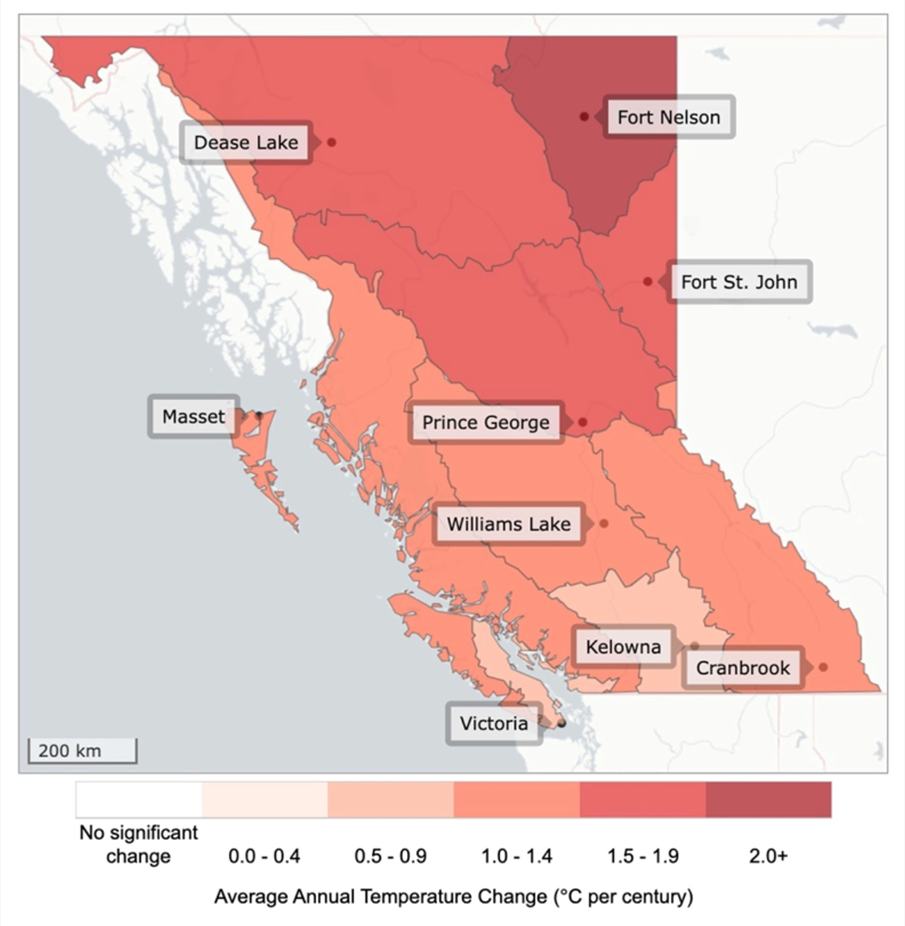
The province has warmed an average of 1.4 C per century from 1900 to 2013, higher than the global average of 0.85 C. The northern regions have warmed 1.6 to 2.0 C, twice the global average. Most of the warming has occurred during winter.
Scientists say as the Earth and in particular the oceans continue to heat up, the “atmospheric rivers” that carry moisture thousands of kilometers from far offshore to points inland, dumping heavy rains that cause flooding, road closures, mudslides and property damage, will become more frequent and more intense.
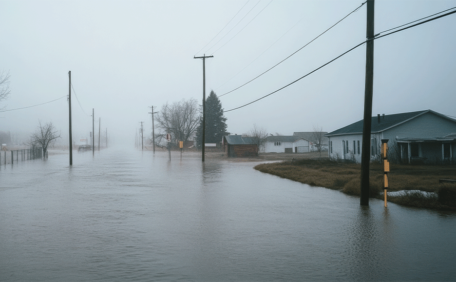
Last weekend, Vancouver Island and the Lower Mainland experienced an atmospheric river almost as strong as the two back-to-back rivers in the sky that hit southern BC in November 2021.
CBC News reported on Tuesday that three people died, and another is still missing, after an atmospheric river washed over the south coast from Friday to Sunday.
Two people drowned on Vancouver Island when their vehicles plunged into a river on a remote stretch of road between Port Alberni and Bamfield. In Coquitlam, a school teacher was killed when a mudslide tore through her home.
Daily rainfall records were set across the Lower Mainland, including in West Vancouver, which received about 190 millimeters, according to Environment Canada. Portions of Vancouver Island got up to 300 mm, or 12 inches of rain.

According to the Vancouver Sun, the rain overwhelmed the city’s storm drain system, leading to widespread flooding.
The storm also brought rain and wind to western Washington State, where up to 150 mm was measured on the Olympic Peninsula. Nearly 15,000 households briefly lost power on Saturday, Oct. 19.
As dangerous as the storm was, it wasn’t as bad as the atmospheric river that pummeled southern BC this time three years ago. That was considered a Category 5, the highest on the Scripps Institution of Oceanography scale. (more on that below)
Five people and thousands of farm animals died, and infrastructure, including roads and bridges, was severely damaged.
What are atmospheric rivers?
Atmospheric rivers may be new to the meteorological lexicon parroted by the media, but they have actually been with us a long time.
“Thing is, we’ve always had them here on the West Coast,” says Johanna Wagstaffe, a meteorologist at CBC News.
Most are familiar with one type of atmospheric river, the “Pineapple Express”, which brings precipitation from near Hawaii to the west coast of North America in the form of warm winds and rains.
But this is only one type of atmospheric river, which are defined as large channels of water in the atmosphere. And when we say large, we mean it. They can be over 1,000 miles long and 250 to 375 miles wide. ARs for short are a type of storm system causing heavy rain or snow, and they occur all over the world.
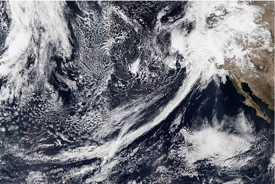
One misconception is that ARs carry rain. In fact they transport water vapor. They are formed when warm ocean water in the tropics evaporates. Winds shape the moisture into a stream and carry it to, say, the West Coast of North America. When an atmospheric river is lifted higher in the atmosphere and it rolls over a mountain range, the moisture cools and falls as rain or snow. As it moves further from the ocean an AR dissipates and the system grows weaker.
As long as atmospheric rivers remain small to mid-size, they are beneficial to the local landscape, naturally replenishing coastal water supplies and mountain snowpacks. According to the US Department of Agriculture’s Climate Hubs,
Atmospheric rivers play important roles in annual water supplies around the world. These weather events supply 30–50 percent of precipitation and account for 90% of south-north water vapor transport for the U.S. west coast.
Ribbons of water vapor called atmospheric rivers wind through the troposphere, moving the planet’s moisture from near the equator toward the poles. These aerial waterways are responsible for about 20%–30% of the annual rain and snow in parts of Europe and the United States and more than 40% in East Asia during that area’s warm season.
In the US Northwest, USDA’s Climate Hubs says atmospheric rivers mostly occur during fall and winter, and they bring much-needed rain to the region:
Between 1950 and 2010, between 60 and 74 percent of persistent drought ended when atmospheric rivers made landfall.
The trouble is when the rain becomes too heavy or the storm stalls over one place, or if one AR is followed rapidly by another, like in November 2021 in southern BC and Washington State. The deluge can overwhelm the land, river systems and sewers. Unable to absorb all that water, flooding occurs.
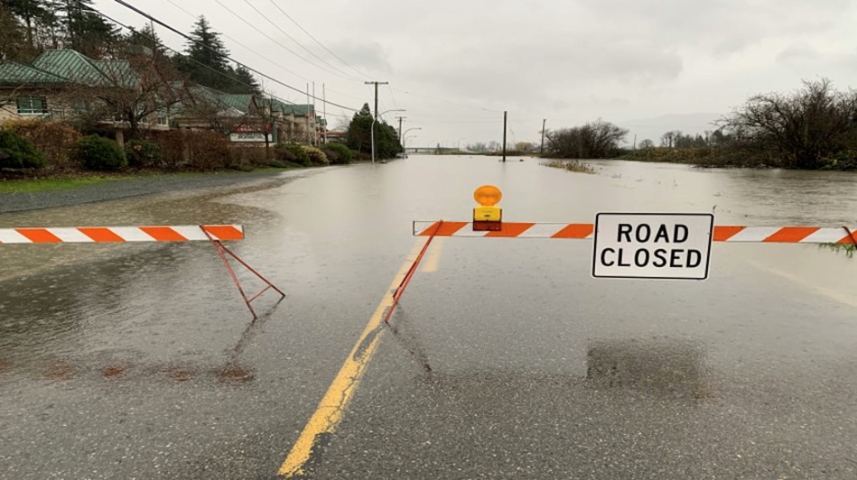
In BC, two days of intense rain brought flooding and mudslides. Bridges collapsed, roads were washed out and cars were stranded along highways. The city of Merritt was evacuated and farms near Abbotsford were flooded completely. In total five people died and thousands of farm animals perished.
Climate Hubs says historically, atmospheric rivers have been associated with 80% of all flooding damage on the West Coast including California, causing about $1 billion of damage every year.
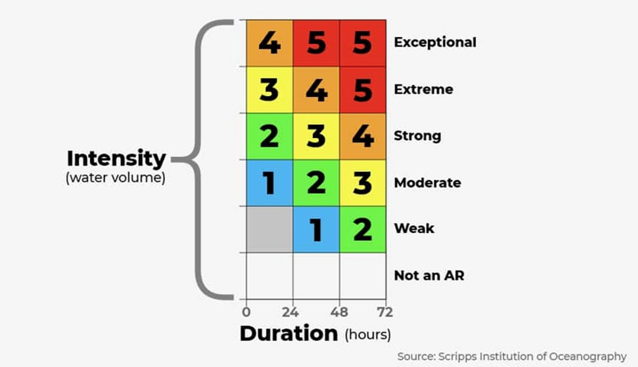
Meteorologists have been working to measure the strength of atmospheric rivers so that their damage can be mitigated. In 2019 The Center for Western Weather and Water Extremes at Scripps Institute of Oceanography (University of California at Davis) created a ratings scale. Like hurricanes, atmospheric rivers are given a rating of 1 to 5, with AR1 being weak and AR5 being most hazardous. The scale estimates the strength of the storm and how long it’ll last.
Ones and twos are generally mild and often provided needed rain to drought-prone areas. Higher ratings can cause flooding and land/mudslides. The intensity of an atmospheric river is usually greatest within a narrow central band and tapers off to the sides.
ARs and global warming
Scientists believe atmospheric rivers could become more common as a result of global warming.
Climate models predict the ARs will also become more intense. That’s because as oceans get warmer, the atmosphere can hold more moisture — about 7% more for every degree the temperature goes up.
Some research quoted by USDA Climate Hubs says that atmospheric rivers are expected to be 25% longer and wider, meaning more rain over more area for longer.
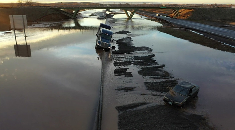
As rainfall increases, the soil is not able to absorb additional water, leading to increased runoff, which can overwhelm rivers and cause flooding and mudslides.
Wildfires are another contributing factor to the damage atmospheric rivers can cause. Fires burn the vegetation that stabilizes hillsides, increasing the chance of slides. One study quoted by USDA Climate Hubs suggests that by 2100, the Northwest may see up to a 7-fold increase in instances where extreme rain events follow periods of high wildfire danger within the same year.
Global warming may also be responsible for changing the timing and distribution of atmospheric rivers. According to EOS,
Rising surface temperatures will continue to increase moisture content in the air, leading to a rise in atmospheric rivers overall, the researchers found. Globally, these events will increase by 84% between December and February and 113% between June and August under continued heavy fossil fuel use. Under medium greenhouse gas emissions, they will increase by 34% and 46% during the same time periods. The north Indian Ocean will see the most substantial increase, with atmospheric rivers doubling or perhaps even tripling in frequency. Greenland will also see a pronounced rise, with the interval between atmospheric rivers shrinking from an average of 59 days to between 30 and 41 days, depending on how fossil fuel consumption progresses.
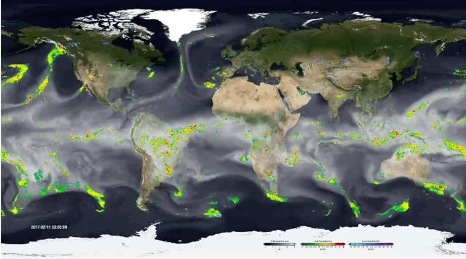
There is even proof to suggest that atmospheric rivers cause sea level rise. Phys.org reported a team of climate specialists found evidence for a rise in ocean levels during future ARs that form in the Pacific Ocean and make their way to the North American coast.
The team studied previous ARs and applied what they learned to ARs in the future, taking into account global warming.
As well as rising ocean levels, partly due to melting ice at the poles, the ocean is also getting warmer. The same carbon dioxide that is warming the planet is making the oceans more acidic.
When CO2 is absorbed by seawater, a series of chemical reactions occur resulting in the increased concentration of hydrogen ions. This process has far reaching implications for the ocean and the creatures that live there. (National Oceanic and Atmospheric Administration)

Ocean level rise along the part of the shoreline where ARs come ashore is similar to storm surges from hurricanes.
By running simulations, the researchers saw that future ARs could raise sea levels by as much as 200%, sinking some communities along the California coast. Southern California is likely to see more sea level rise than Northern California, thus inflicting more damage.
A shift towards the poles
One of the most alarming trends is that atmospheric rivers are shifting towards higher latitudes, changing weather patterns around the world.
According to The Conversation,
The shift is worsening droughts in some regions, intensifying flooding in others, and putting water resources that many communities rely on at risk. When atmospheric rivers reach far northward into the Arctic, they can also melt sea ice, affecting the global climate.
In a new study published in Science Advances, University of California, Santa Barbara, climate scientists Qinghua Ding and Z Li show that atmospheric rivers have shifted about 6 to 10 degrees toward the two poles over the past four decades…
In North America, that means more atmospheric rivers drenching British Columbia and Alaska.
According to the study, a main reason for the shift is changes in sea surface temperature in the eastern tropical Pacific. Waters in this area have been cooling since 2000, often associated with the La Nina climate phenomenon, pushing atmospheric rivers towards the poles.
Conversely, during El Ninos (like in 2023-24), when Pacific Ocean temperatures are warmer, atmospheric rivers don’t travel as far from the equator.
The reason this is important is that a shift in atmospheric rivers can have major effects on local climates. The Conversation explains:
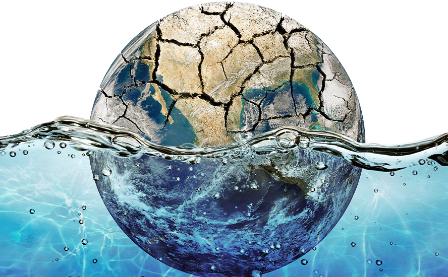
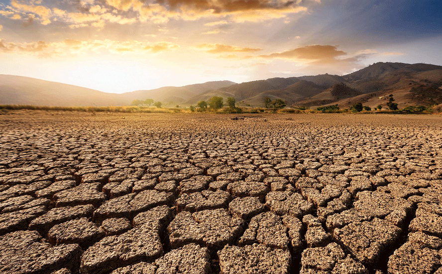
In the subtropics, where atmospheric rivers are becoming less common, the result could be longer droughts and less water. Many areas, such as California and southern Brazil, depend on atmospheric rivers for rainfall to fill reservoirs and support farming. Without this moisture, these areas could face more water shortages, putting stress on communities, farms and ecosystems.
In higher latitudes, atmospheric rivers moving poleward could lead to more extreme rainfall, flooding and landslides in places such as the U.S. Pacific Northwest, Europe, and even in polar regions.
Conclusion
Atmospheric rivers can be good or bad depending on their strength and frequency. Areas frequently hit by these “rivers in the sky” will see more soil erosion and therefore often swollen rivers and widespread flooding. Wildfire erosion is also a contributing factor.
Weak to medium-strength atmospheric rivers can bring needed rainfall and snowfall to drought-prone areas without causing massive damage.
The continued warming of the planet will increase the power and duration of atmospheric rivers. The atmosphere can hold about 7% more moisture for every degree the ocean heats up.
Atmospheric rivers also cause sea level rise similar to storm surges during hurricane season in the northern hemisphere and the monsoon season in the southern hemisphere.
Meanwhile, a poleward shift over the past four decades has meant more atmospheric rivers drenching British Columbia and Alaska.
There is little we can do to stop global warming in all its manifestations, including atmospheric rivers. The Earth will continue to warm until it starts cooling, following geological cycles going back millions of years.
The best we can do is try to maintain existing road and housing infrastructure to minimize the damage ARs cause, and when possible, build new infrastructure to protect flood-prone areas.
It could be as simple as clearing blocked storm drains — something that residents complained wasn’t done in parts of the Lower Mainland — despite ample warning of the impending atmospheric river.

Subscribe to AOTH’s free newsletter
Richard (Rick) Mills
aheadoftheherd.com
subscribe to my free newsletter
Legal Notice / Disclaimer
Ahead of the Herd newsletter, aheadoftheherd.com, hereafter known as AOTH.Please read the entire Disclaimer carefully before you use this website or read the newsletter. If you do not agree to all the AOTH/Richard Mills Disclaimer, do not access/read this website/newsletter/article, or any of its pages. By reading/using this AOTH/Richard Mills website/newsletter/article, and whether you actually read this Disclaimer, you are deemed to have accepted it.
Share Your Insights and Join the Conversation!
When participating in the comments section, please be considerate and respectful to others. Share your insights and opinions thoughtfully, avoiding personal attacks or offensive language. Strive to provide accurate and reliable information by double-checking facts before posting. Constructive discussions help everyone learn and make better decisions. Thank you for contributing positively to our community!



#globalwarming #Atmosphericrivers
Hi,
I am not a scientist but did some superficial research about 6 years ago into any reports on the effects of large scale deforestation on the Jetstream and its routing. I did find some reports as far back as the eighties showing that it does indeed affect the Jetstream. I also had the general impression of a rough timeline over the last 100 years where unusual weather around the world seemed to follow large scale deforestation. I assume when they use the ‘buzz phrase ‘Atmospheric Rivers’ that they are talking about the Jetstream? Has any proper recent research been done on this? I ask because every time I raise the subject my questions are ignored. The uncharitable might assume because it does not fit the current ‘agenda’ It seems very logical to me that if we corrupt the Jetstream routes this is probably going to cause the crazy weather patterns we are seeing ! The TV Weather Forecasters very often quote the problem with the weather patterns is caused by the Jetstream and show such on their charts ! I could be cynical but I won’t, just my observations.