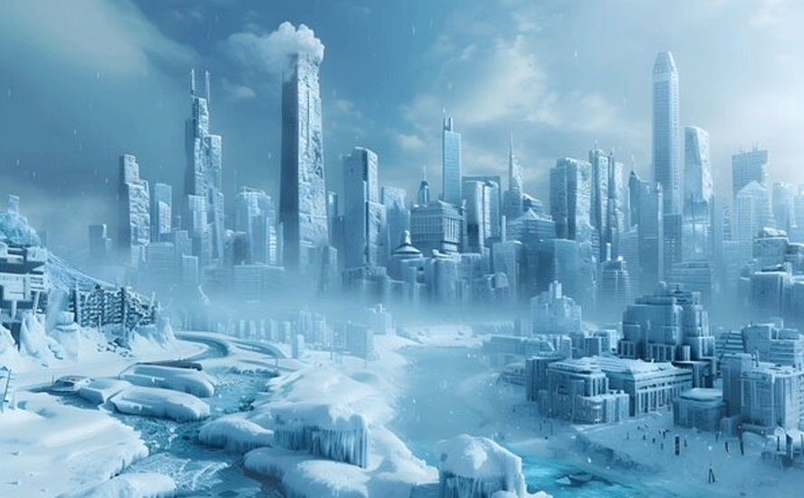
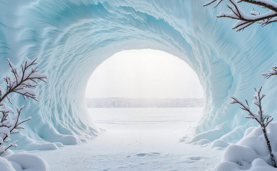
Polar vortex breakdown unleashes massive winter storm affecting two-thirds of United States – Richard Mills
2026.01.24
Hundreds of millions of Americans are facing a weekend of wild winter weather as a storm gathered strength Friday, bringing sub-zero temperatures, snow and ice to the eastern two-thirds of the country.
Forecasters quoted by PBS have the storm stretching from New Mexico to New England and across the Deep South. About 230 million people are likely to encounter temperatures of 20 degrees Fahrenheit or -7 Celsius, while another 130 million are expected to receive snow and ice. Many Americans will receive both, states the National Weather Service.
Meteorologists said the storm, which originates in the Arctic, could rival the damage wrought by a hurricane, and warned that the frigid conditions could last through the rest of the month and into February.
A combination of polar air reaching much further south than normal is mixing with heavy moisture from California and the Gulf of Mexico to produce the “perfect” winter storm.
Some meteorologists are calling it the “storm that defines the entire winter”. One, Pam Knox, director of the University of Georgia Weather Network, said it may be a “generational storm” for people living in the Deep South who are not accustomed to such extreme winter weather.
She said, via CBC News, that apart from treacherous road conditions, there’s the risk of ice-laden power lines falling down and causing outages.
According to NBC News,
- At least 172 million people are under some form of winter weather warning through Sunday.
- Up to a foot of snow is likely on the northern side of the system from Oklahoma to Massachusetts, according to the National Weather Service. On the southern side — which includes Texas, the Carolinas and Virginia — mixed precipitation is more likely.
- Gusty winds are expected to drop wind chills below zero, with minus 50 degrees Fahrenheit possible in the northern and central Plains. Severe to catastrophic ice accumulation is possible and could lead to prolonged power outages, worsen the impacts of the cold weather and create hazardous travel conditions.
- Over a dozen states have declared emergencies, and officials are urging residents to prepare for the storm and stay indoors.
Polar vortex responsible
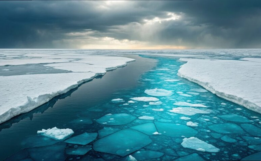
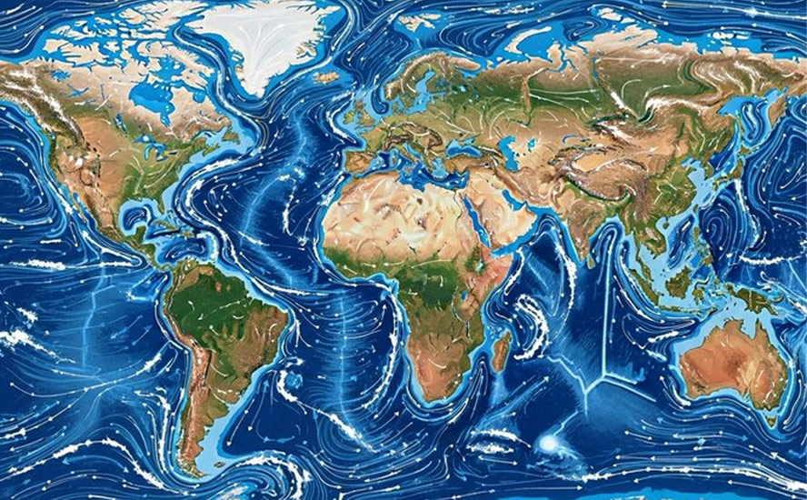
As is often the case, and more so with increasing global warming, the origin of the storm is a weakening of the “polar vortex”.
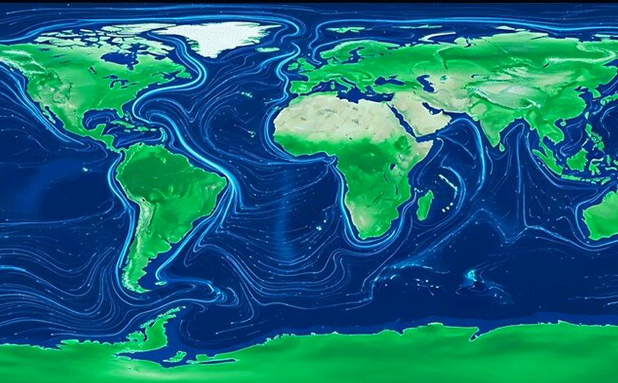
The polar vortex is a seasonal atmospheric phenomenon whereby high winds swirl around an extremely cold pocket of Arctic (or Antarctic) air. The winds are like a barrier that contains cold air, but when the vortex weakens, the frigid air “escapes” from the vortex and travels south, bringing with it a freezing cold blast of Arctic weather.
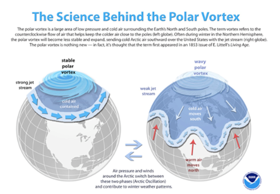
It may sound counterintuitive, but the weakening of the polar vortex is actually due to warming happening in the stratosphere, about 30 km above the North Pole. Called Sudden Stratospheric Warming, this meteorological event breaks down the area of low pressure and cold air surrounding the pole, allowing cold air to spill out into the midwestern/ eastern US, and parts of western/ central Canada, and for the warmer air to hang over the Arctic.
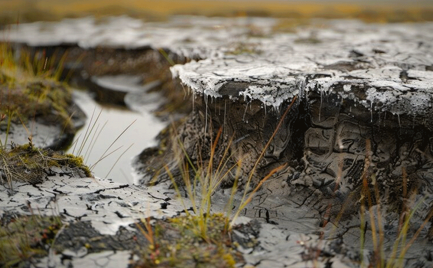
How does climate change affect the polar vortex? The answer is warming oceans. As more ice melts during the summer, the Arctic Ocean heats up. The effect is less pronounced in Antarctica because it’s a landform not a polar ice cap. That heat gets radiated back to the atmosphere in winter, which reduces the intensity of the northern polar vortex winds. The polar vortex gets disrupted, allowing cold air in the center of the swirling cyclone above the pole to migrate south. According to Scientific American, in years when a lot of Arctic sea ice disappeared, the vortex was more likely to weaken.
Along with escaping cold Arctic air that flows into parts of the Northern Hemisphere, a distorted polar vortex also warms polar regions.
In fact, the poles are warming faster than anywhere else on the planet. Canada, where the Arctic makes up 40% of its land mass, is warming at a rate twice as fast as the rest of the world – and will continue to do so.
This is the phenomenon of the “wavering jet stream”. The polar jet stream crosses the North Atlantic from west to east and determines the paths of weather systems. As the Arctic warms, it causes the jet stream to become weaker and wavier, allowing cold polar air to reach further south and warm air to stretch north. This makes weather systems linger in the same locations for longer, such as the 2019 summer hot spell that baked Europe, and the cold snap that froze the eastern and midwestern United States the same year.
Meteorologists use something called the Arctic Oscillation (AO) index to gauge the extent to which blobs of cold air are held above the Arctic or meander south. A positive AO indicated cold air trapped in the Arctic, where it belongs, versus a negative AO whereby the cold escapes and moves south.
The breakdown of the polar vortex and wavering jet stream theory are a good defense of global warming against critics who claim that exceedingly cold winters in certain cities are proof that climate change is not real; in fact, these events are just another manifestation of our warming and changing climate.
Should we expect more of these polar vortex breakdowns? The answer is yes, but the longer-term trend is towards more warming than cooling. The World Meteorological Association states that cold waves are becoming more infrequent as a result of climate change, but they will continue to be a part of typical weather patterns in the Northern hemisphere winter.
In its Fifth Assessment Report, the Intergovernmental Panel on Climate Change writes that it is “virtually certain that there will be more frequent hot and fewer cold temperature extremes over most land areas on daily and seasonal timescales as global mean temperatures increase. It is highly likely that heat waves will occur with a higher frequency and duration. Occasional cold winter extremes will continue to occur.”
A study in the Bulletin of the American Meteorological Society found that a weakening polar vortex over the past 40 years, brought on by a melting Arctic, explained 60% of the cooling in Eurasia since 1990. The scary part of all this is the specter of the polar vortex collapsing. This would mean a total disruption of normal atmospheric warming and cooling. Without halos of swirling Arctic and Antarctic winds serving to cool the poles, they would be left to heat up, accelerating global warming.
In this case, PBS explains that the origins of the storm system began in the Arctic, where relatively warmer temperatures add energy to the polar vortex and push its cold air south.
“The atmosphere is aligned perfectly that the pattern is locked into this warm Arctic, cold continent,” said former National Oceanic and Atmospheric Administration chief scientist Ryan Maue. “And it’s not just here for us in North America, but the landmass of Eastern Europe to Siberia is also exceptionally cold. The whole hemisphere has gone into the deep freeze.”
Stretched polar vortex
Unique to this winter storm is the fact that the polar vortex is being “stretched”. MIT research scientist Judah Cohen, a winter weather expert, told PBS that in October, changes in the Arctic and low sea ice were setting up conditions for a stretched polar vortex that brings severe winter weather to the US. Cohen co-authored a July 2025 study that found more stretched polar vortex events linked to severe winter weather bursts in the central and eastern U.S. over the past decade. Cohen said part of the reason is that dramatically low sea ice in the Barents and Kara seas in the Arctic helps set up a pattern of waves that end up causing U.S. cold bursts. A warmer Arctic is causing sea ice in that region to shrink faster than other places, studies have found.Arctic sea ice is at a record low extent for this time of year, according to the National Snow and Ice Data Center.
Where the storm will hit
The center of the stretched polar vortex is expected to be above Duluth, Minnesota by Friday morning, plunging temperatures in the North and Midwest down to -25 or -30 degrees F.
The average low for the Lower 48 states will hover around 12 degrees on Saturday, Sunday and Monday. Two of the Great Lakes — Erie and Ontario — could freeze up.
Most areas east of the Rockies will be impacted by the bitter cold, snow or ice, a meteorologist with the national Weather Prediction Center told PBS, with freezing rain through the southern plans through the Mid-South and into the Carolinas bringing the potential for power outages; and significant snowfall accumulations hitting “the Ozarks region, Tennessee and Ohio valleys, the central Appalachians, and then into the mid-Atlantic, and perhaps into the portions of the northeast.”
CBC News reported the storm area impacts about 55% of the population of the contiguous United States, and includes major cities from Dallas and Nashville to Washington and Baltimore.
CTV News said ice and snow could begin falling later Friday in Texas and Oklahoma, then is expected to move South with freezing rain and sleet, before heading into the Northeast, dumping about a foot of snow from Washington, DC, through New York and Boston.
More than 1,000 flights were delayed on Friday, with over half of them in Dallas. Schools in Chicago and across the Midwest were canceled due to predicted temperatures with wind chills as low as -40 F, so cold that exposed skin is frost-bitten within 10 minutes.
What about Canada?
The Maritime provinces are expected to be hit by polar air when it arrives on Friday and into this weekend. In New Brunswick, lows will fall to between -18 and -24 Celsius, or into the -30s with the wind chill.
Prince Edward Island lows will range from -15 to -18, feeling into the -20s, while for Nova Scotia, low temperatures will be between -12 and -17, and -18 to -24 with wind chill.
According to CTV News, when the storm moves out of New England Sunday, it becomes a Nor’easter that could impact the Maritimes with significant snowfall, Monday.
As of Thursday afternoon, southern areas of New Brunswick, all of Nova Scotia, and eastern Prince Edward Island were looking most at risk of a heavy snow, defined as 15 or more centimeters.
From Global News comes the following concerning most of Western Canada, “Environment Canada has issued several orange-level cold warnings across the country on Friday morning, as some regions are expected to see temperatures as low as -50 with the wind chill.
All of Saskatchewan and Manitoba are under the orange level — a second-tiered warning — for cold. These are issued when severe weather is likely to cause significant damage, disruption, or health impacts.
A large section of northwestern Ontario is also under the same warning.
According to the warning, the “multi-day episode” of very cold wind chills continues with temperatures ranging anywhere from -40 to -50 across the Prairie provinces, and -40 to -48 in northwestern Ontario.
Richard (Rick) Mills
aheadoftheherd.com

Legal Notice / Disclaimer
Ahead of the Herd newsletter, aheadoftheherd.com, hereafter known as AOTH.Please read the entire Disclaimer carefully before you use this website or read the newsletter. If you do not agree to all the AOTH/Richard Mills Disclaimer, do not access/read this website/newsletter/article, or any of its pages. By reading/using this AOTH/Richard Mills website/newsletter/article, and whether you actually read this Disclaimer, you are deemed to have accepted it.


